
Transit Guide
The Honolulu Skyline Guide
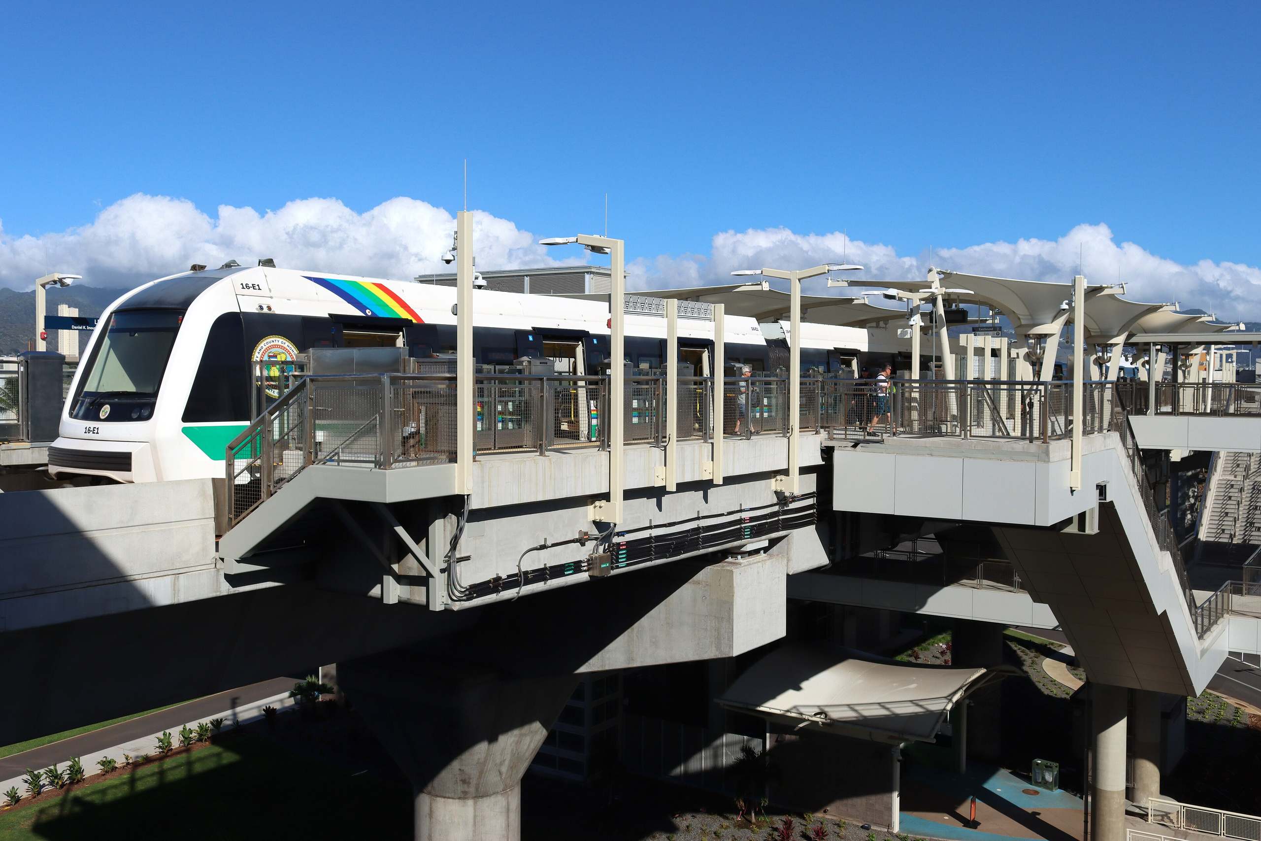
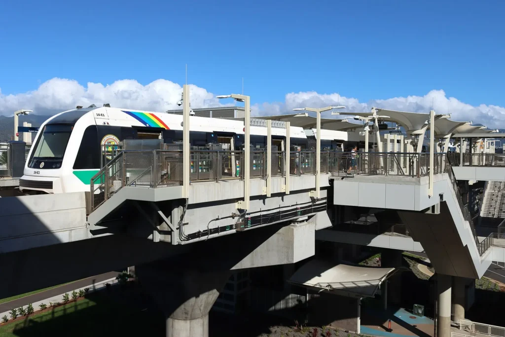
Skyline is Honolulu’s driverless rail line. It runs 16 miles from East Kapolei to the Kalihi Transit Center, stopping at the airport and at the station for Pearl Harbor, and it does not reach Waikiki. This guide covers fares, hours, getting to the train from Waikiki, all 13 stations, and what is being built next, checked against the city’s and HART’s own pages in October 2026.
Some links on this page are affiliate links. If you book or buy through them, we may earn a commission at no extra cost to you.
Quick Answer
Short version: Skyline runs from 4 AM to 10:30 PM every day, every 10 minutes until 8:30 PM, and takes about 34 minutes end to end. It stops at the airport and at Hālawa, the station for the Pearl Harbor Visitor Center, but not in Waikiki: ride TheBus W Line to the Āhua or airport station and change there. You need a HOLO card, and $3 buys two hours of rides on Skyline and TheBus together.
Should You Ride Skyline?
Ride it if your day takes you along the south shore between the airport and the west side. Skyline gets you from Waikiki to the Pearl Harbor Visitor Center without a car (the W Line bus to the train, then the train to Hālawa and a walk), and it links the airport, Pearlridge, the Aloha Stadium Swap Meet, and the bus to Ka Makana Aliʻi from Keoneʻae station. Trains are fully automated and run on an elevated guideway for all but a short stretch, away from street traffic.
Skip it for Waikiki, which has no Skyline station. Skip it for Downtown, Chinatown and Ala Moana too, which have no station yet, and for the North Shore, the windward beaches and the east side, none of which has a Skyline station. For those days, browse the things to do in Oahu guide by region, and read whether you need to rent a car on Oahu. If you do keep a car in town, the city’s four park-and-ride lots at Keoneʻae, Honouliuli, Hālawa and Kahauiki, free to transit riders for up to 24 hours, let you leave it by a station, and our Waikiki parking guide covers what it costs to park back at your hotel.
Mind the station names: the station called Makalapa (Joint Base Pearl Harbor-Hickam) is not the Pearl Harbor visitor stop. The city sends visitors to Hālawa, one stop west.
Plan Your Ride: Fares, HOLO Card and Hours
Get a HOLO card first. Everyone over 5 needs one to ride Skyline; the train takes no cash. Adult cards loaded with a pass are sold at the HOLO vending machines in every Skyline station (including Lelepaua at the airport) and at ABC Stores in Waikiki. ABC Stores sell only cards preloaded with an adult day pass and do not reload them; the station machines reload any HOLO card, and you can also load one online at holocard.net. Station machines sell adult passes only. The card itself costs $2. One child 5 or under rides free with each paying rider, as long as the child is not taking a seat.
Fares are the same as TheBus. Tap your card on the reader at the fare gate (it sits on your right), and tap again on the reader whenever you change between Skyline and TheBus: transfers are free for two hours from your first paid tap. The Day Cap and the 24-Hour Pass cost the same but work differently. The cap stops charging you once you have paid $7.50 that day, while the pass runs 24 hours from your first tap, so it can carry into a second morning.
Hours. Trains run from 4 AM to 10:30 PM every day, weekends and holidays included: every 10 minutes until 8:30 PM, then every 15 minutes. The last trip along the whole line leaves Kualakaʻi at 10 PM; later trips stop short, at Kalauao (Pearlridge) or Pouhala (Waipahu). For live arrivals, use the Transit app, the city’s official app since it retired DaBus 2 in April 2026. It is free on iOS and Android and covers TheBus, Skyline and Biki.
Bags, bikes and food. Each rider can bring one standard suitcase and one smaller carry-on, kept in front of or next to you, out of the aisle and off the seats; every train has luggage racks, and wide fare gates fit luggage and bikes. Bikes and e-bikes go on the racks by the train doors, and you walk them inside stations and trains. Sealed drinks and covered food are fine, open food and drinks are not, and smoking and vaping are banned on trains and within 20 feet of a station. Service animals ride; other small animals must be in a carrier. For help with a card, the HOLO helpline is (808) 768-4656, 7:30 AM to 4 PM on weekdays.
| Fare | Price | How it works |
|---|---|---|
| 2-Hour Pass | $3.00 | 2 hours of unlimited transfers between Skyline and TheBus from your first tap |
| Day Cap | $7.50 | Pay as you go; once you have paid $7.50 in a day, the rest of that day is free |
| 24-Hour Pass | $7.50 | 24 hours from your first tap |
| 3-Day Pass | $20.00 | 72 hours from your first tap |
| 7-Day Pass | $45.00 | 168 hours from your first tap |
| Monthly Pass or Month Cap | $90.00 | The cap and the pass cost the same |
| HOLO card | $2.00 | One-time card fee, new or replacement |
| Cash (TheBus only) | $3.25 | Exact fare, no transfers; not accepted on Skyline |
Getting from Waikiki to Skyline
Take TheBus W Line, then change to the train at Āhua or the airport. The W Line is the city’s limited-stop bus between Waikiki and the airport’s Lelepaua station. It runs through Waikiki on Kuhio Avenue, its Waikiki end is on Kapahulu Avenue opposite Cartwright Road, and it also stops on Ala Moana Boulevard at Kahanamoku Street and at Ala Moana Center. It boards only at the stops on TheBus’s W Line stop list, so find the one nearest your hotel before you go. On TheBus’s timetable (effective May 31, 2026) it comes every 10 minutes at weekday rush hours, every 15 minutes through most of the rest of the day until 7 PM, and every 20 to 30 minutes after that.
Heading west toward Pearl Harbor, get off at the Lagoon Drive at Ualena Street stop for the Āhua station, the first Skyline stop the bus reaches. TheBus’s weekday timetable works out to about 35 minutes from the Kapahulu end, and about 40 minutes to the airport. Pay with your HOLO card on the bus, and the train ride is part of the same two-hour fare. Cash works on the W Line but buys no transfer, so you would pay again for the train. TheBus and Skyline share the same luggage rule: one standard suitcase and one smaller carry-on per rider.
- Coming back late. Skyline stops at 10:30 PM, but TheBus’s W Line timetable (effective May 31, 2026) lists weekday departures from the airport until 1:30 AM. Route 42 also serves the airport station after 10:30 PM.
- At the airport. The W Line uses a temporary stop on the ground level of Ala Onaona Street, across from the lei stands and directly across from the Lelepaua station. A permanent stop in front of the station is being built.
- Other places from Āhua. The A Line runs to Downtown and UH Mānoa, and the U Line to UH Mānoa by the H-1. For Ala Moana Center, stay on the W Line.
- The long way. Route 42 and the E (CountryExpress) also run between Waikiki and the Waipahu Transit Center at Pouhala station, but they are long suburban runs. The W Line is the fast option.
Landing at HNL and going straight to your hotel? Our Honolulu airport to Waikiki guide compares the W Line with shuttles, taxis, rideshare and rental cars.
Skyline Station by Station
The 13 stations are numbered west to east, the same numbers as the map at the top of this page, and each has a Hawaiian name and a place name. Every station has elevators and stairs, HOLO ticket machines and bike racks near the entrances. The meanings of the names come from HART, the agency building the line. Bus routes are from the city’s station maps, which change with each new bus schedule, so check the Transit app before you rely on one.
East Kapolei and ʻEwa
The west end of the line, through new neighborhoods on the ʻEwa plain. Two of these four stations have free park-and-ride lots.
Kualakaʻi · East Kapolei
The first station on the line, at Kualakaʻi Parkway and Keahumoa Parkway, serving Kapolei, Makakilo and ʻEwa Beach. HART translates the name as “to show the way, stand and lead.”
- Nearby
- The Salvation Army Kroc Center Hawaiʻi (the city’s rider guide puts the station next to it) and Honouliuli Middle School.
- Buses
- Routes C, 44, 46 and 47 among others. Check the Transit app for times.
- Good to know
- The full ride to Kahauiki, at the other end of the line, takes about 34 minutes.
Keoneʻae · UH West Oʻahu
The campus station, at Kualakaʻi Parkway and Hoʻomohala Avenue. HART translates the name as “fine, soft, powdery sand.”
- Nearby
- UH West Oʻahu, and a bus transit center at the station.
- Buses
- Routes C, 40, 44, 46 and 47 among others; the city lists the C, 44, 46 and 47 among the buses from here to Ka Makana Aliʻi. Check the Transit app for times.
- Parking
- Free park-and-ride, 304 stalls, entered from Hoʻomohala Avenue off Kualakaʻi Parkway. 24-hour limit.
Honouliuli · Hoʻopili
A park-and-ride station for the Hoʻopili homes, at the mauka end of Kamālie Mua Street. HART translates the name as “dark bay.”
- Nearby
- The residential communities of Honouliuli.
- Buses
- None. TheBus does not serve this station.
- Parking
- Free park-and-ride, 344 stalls, entered from Kamālie Mua Street off Hoʻomohala Avenue. 24-hour limit.
- Art
- The first of HART’s embossed columns, honoring the Honouliuli ahupuaʻa: the flow of wind, coral, sea salt beds, the first planting of the ʻulu tree, rain, and the sun rising over Puʻuokapolei.
Hōʻaeʻae · West Loch
On Farrington Highway at Leoole and Leoku Streets, serving West Loch, ʻEwa Beach and Waipahu. HART translates the name as “to make soft or fine.”
- Nearby
- A post office and a bus transit center, both on the city’s station map.
- Buses
- Routes E, 40, 42 and 43 among others. Check the Transit app for times.
Waipahu and Pearl City
Three stations for Waipahu, Waikele and Pearl City, including the Waipahu Transit Center and the only station at ground level.
Pouhala · Waipahu Transit Center
At Farrington Highway and Hikimoe Street, serving Waipahu and Waikele. HART translates the name as “pandanus post or pillar.”
- Nearby
- Waipahu Public Library and Waipahu Civic Center.
- Buses
- The Waipahu Transit Center beside the station has bays 1 to 5; routes include the E, 40, 42 and 43, and Bay 5 has the E and 42 to Waikiki. Check the Transit app for times.
- Good to know
- Some late trips after 10 PM end here rather than at the end of the line.
Hālaulani · Leeward Community College
In the campus parking lot of Leeward Community College, serving the campus and Waikele. HART translates the name as “heavenly hālau, chief’s house, name of a star.”
- Nearby
- Leeward Community College.
- Buses
- None. TheBus does not serve this station.
- Good to know
- The only station at ground level. The rest of the line is elevated, apart from the 0.6-mile stretch here.
Waiawa · Pearl Highlands
At Kamehameha Highway and Kuala Street, serving Pearl Highlands and Pearl City. HART translates the name as “milkfish water.”
- Nearby
- Pearl Highlands Center.
- Buses
- Routes 43, 51, 531, 532 and 535; the 533 on weekends. Check the Transit app for times.
- Good to know
- HART plans a bus transit center and an H-2 access ramp here for Central Oahu and North Shore buses. Neither is built yet.
Pearlridge and Pearl Harbor
Three stations for shopping, the stadium and swap meet, and the Pearl Harbor Visitor Center.
Kalauao · Pearlridge
At Kamehameha Highway and Kaonohi Street, serving Pearl City, Waimalu and Aiea. The city points riders here for Pearlridge, Pearl Kai and the shops around them. HART translates the name as “the multitude of clouds.”
- Nearby
- Pearlridge Center and Pearl Kai Shopping Center; Westridge Shopping Center, Waimalu Shopping Center and Harbor Center are on the city’s station map.
- Buses
- Routes 32, 40, 42, 51 and 53 among others. Check the Transit app for times.
- Good to know
- Some late trips after 10 PM end here rather than at the end of the line.
Hālawa · Aloha Stadium
At Kamehameha Highway and Salt Lake Boulevard, serving the stadium, Aiea, Salt Lake and Moanalua. HART translates the name as “curve.”
This is the Pearl Harbor stop. The city’s directions: from the station, cross Kamehameha Highway to the ocean side and walk east to the Pearl Harbor Visitor Center. You can also take TheBus Route 40, 42 or 51 one stop from the bus stop across from the station. The Aloha Stadium Swap Meet takes place here every Wednesday, Saturday and Sunday. With 590 free stalls, this is also the biggest park-and-ride on the line.
- Nearby
- Aloha Stadium, the Pearl Harbor Visitor Center, and a bus transit center.
- Buses
- Routes 1L, 32, 40, 42, 51 and more. Check the Transit app for times.
- Parking
- Free park-and-ride, 590 stalls, entered from Salt Lake Boulevard. 24-hour limit.
- Good to know
- The end of the line from 2023 until October 2025.
Makalapa · Joint Base Pearl Harbor-Hickam
At Kamehameha Highway and Radford Drive, serving the Pearl Harbor naval base, Hickam and Salt Lake. HART says the name means “ridge face or front,” for the outer walls of the crater.
Not the visitor stop. The station is named for the base and sits by its Makalapa Gate, which is restricted, and entering secured military space takes valid ID. For the Pearl Harbor Visitor Center, the city routes riders through Hālawa, one stop west.
- Nearby
- The Pearl Harbor Makalapa Gate (restricted access).
- Buses
- Routes 40, 42, 51, 331 and PH8. Check the Transit app for times.
- Good to know
- The first of the four stations that opened on October 16, 2025.

Pearl Harbor, USS Arizona Memorial and Honolulu Deluxe Coach Tour
★★★★★ 4.9 · 5,037 reviews · From $59
Check AvailabilityWe may earn a commission if you book through this link, at no extra cost to you.
Airport and Kalihi
The three newest stations: the airport, the transfer to Waikiki, and the current end of the line.
Lelepaua · Daniel K. Inouye International Airport
On the mauka side of Terminal 2, at Ala Onaona and Ala ʻAuana Streets. HART says the name refers to a land section of the pāpaua bivalve, whose choice mother of pearl was used for fishing lures and hooks.
Getting to the terminals. Pedestrian bridges and walkways connect the station to Terminals 1, 2 and 3 and to the fourth floors of the Terminal 2 and International parking garages, and there is a ground-level entrance from Ala Onaona and Ala ʻAuana Streets. The station’s ticket machine sells adult HOLO cards, so you can buy one when you land. Each rider can bring one standard suitcase and one smaller carry-on, and every train has luggage racks.
- Nearby
- Terminal 2, the lei stands, and the Terminal 1, Terminal 2 and International parking garages.
- Buses
- The W Line to Waikiki, from the temporary stop across from the lei stands; Route 42 after 10:30 PM. Check the Transit app for times.
- Good to know
- Skyline reached the airport on October 16, 2025.
Āhua · Lagoon Drive
At Lagoon Drive and Waiwai Loop, serving the airport business district and Māpunapuna. HART translates the name as “a hillock or mound.”
- Nearby
- The airport business district.
- Buses
- The A, U and W Lines, plus Routes 40, 42 and 51 among others. Check the Transit app for times.
- Good to know
- The city’s transfer point for Downtown, UH Mānoa and Waikiki: the W Line to Waikiki, the A Line to Downtown and UH Mānoa, and the U Line to UH Mānoa.
Kahauiki · Kalihi Transit Center
The current end of the line, at Kamehameha Highway and Middle Street. A pedestrian bridge leads straight to the platform of the Kalihi Transit Center. HART translates the name as “the little hau (hibiscus) tree.”
- Nearby
- The Kalihi Transit Center.
- Buses
- More than a dozen routes, including the 1, 2, 40, 42, 51 and C. Check the Transit app for times.
- Parking
- Free park-and-ride, 95 stalls, entered from Middle Street. 24-hour limit.
Skyline Construction: What Is Being Built Next
As of Oct 12, 2026, from HART’s construction pages: Skyline runs 16 miles and 13 stations, and the next 3 miles are under construction. Plan on the train ending at Kalihi until City Center service starts, which HART projects for 2031, and on TheBus for anything east of it.
Segment 3, City Center. Six stations from Mokauea (Kalihi) to Kaʻākaukukui (Civic Center): Mokauea, Niuhelewai (Honolulu Community College), Kūwili (Iwilei), Hōlau (Chinatown), Kuloloia (Downtown) and Kaʻākaukukui. HART expects the first guideway span in early 2027, major construction to finish in 2030, and passenger service in 2031, and says schedules can change. Ground was broken at the Kaʻākaukukui site in August 2025, guideway column work began in October 2025, station foundations started in Chinatown in April 2026, and the Downtown utility relocation finished on July 22, 2026. Utility work on Dillingham Boulevard is expected to finish in late 2026. These six stations will have elevators and stairs instead of escalators.
Kakaʻako and Ala Moana. The original plan ran 20 miles to Ala Moana Center. HART now calls Civic Center a temporary terminus: the last two stations, Kūkuluaeʻo (Kakaʻako) and Kālia (Ala Moana Center), are not in the current funded scope, and funding, schedule and delivery plans have not been finalized, so they have no opening year. The city will decide bus connections beyond Civic Center as its operating plans develop.
| Stretch | Stations | Length | Status |
|---|---|---|---|
| Segment 1 | Kualakaʻi (East Kapolei) to Hālawa (Aloha Stadium) | 10.75 miles, 9 stations | Open since June 30, 2023 |
| Segment 2 | Makalapa (Joint Base Pearl Harbor-Hickam) to Kahauiki (Kalihi) | 5.2 miles, 4 stations | Open since October 16, 2025 |
| Segment 3, City Center | Mokauea (Kalihi) to Kaʻākaukukui (Civic Center) | 3 miles, 6 stations | Under construction; service projected for 2031 |
| Kakaʻako and Ala Moana | Kūkuluaeʻo (Kakaʻako) and Kālia (Ala Moana Center) | 2 stations | Not in the funded scope; no date set |
Skyline History and Engineering
Skyline is a fully automated, driverless light metro powered by a third rail, with a fleet of twenty four-car trains. The guideway is elevated for the whole route except a 0.6-mile ground-level section near Leeward Community College, which keeps trains away from street traffic, pedestrians and intersections. HART warns that automated trains can move in either direction at any time; stations have platform screen gates, and more than 1,500 security cameras watch the system. Each station is designed to reflect the community it serves, and the columns will carry embossed patterns by local architect and designer Daniel Kanekuni of WCIT Architecture, unique to each area’s ahupuaʻa (traditional land division). HART launched a $5 million transit art program for the stations in 2013.
The line took two decades to reach the airport:
- 2005 to 2010. The Legislature authorized a 0.5% General Excise Tax for transit in 2005. The City Council chose a fixed guideway in 2006 and backed a 20-mile first phase from East Kapolei to Ala Moana Center in 2007. Voters confirmed steel-wheel-on-steel-rail technology in 2008, the route moved from Salt Lake to the airport in 2009, and voters created HART in 2010.
- 2011 to 2013. A ceremonial groundbreaking was held at the East Kapolei station site in February 2011. In August 2012 the State Supreme Court ruled that archaeological studies had been improperly phased, and construction stopped. That December the Federal Transit Administration signed a $1.55 billion Full Funding Grant Agreement, about 32% of the project’s estimated $5.1 billion cost at the time. Work resumed in September 2013.
- 2016 to 2021. The Legislature extended the excise tax surcharge in 2016 and again in 2017, the second time with a 1% Transient Accommodation Tax increase, to December 2030. Rail operations passed from HART to the city’s Department of Transportation Services in November 2016. The third rail was energized in September 2020 for test trains between East Kapolei and Aloha Stadium, and in December 2021 the City Council approved a 3% city transient accommodations tax for rail.
- 2022 to 2024. HART’s 2022 Recovery Plan cut the project to 18.9 miles and 19 stations, postponing the final 1.25 miles of guideway, the Kakaʻako and Ala Moana stations, and the Pearl Highlands parking garage. An amended federal grant agreement was signed in February 2024, and in April 2024 HART received $125 million, its first federal funding since 2017. The City Center design-build contract went to Tutor Perini that August.
- 2023 and 2025. The first nine stations, East Kapolei to Aloha Stadium, opened on June 30, 2023. The next four, from Makalapa to Kalihi, opened on October 16, 2025, bringing the train to the airport.
That 2016 handover is why the city runs the trains while HART builds the line.
Rental car
Compare Oahu Rental Cars
Skyline covers the south shore between Kapolei and Kalihi. For the North Shore and the windward beaches, DiscoverCars searches Oahu’s rental agencies in one go. Compare Oahu rental cars on DiscoverCars.
We may earn a commission if you book through this link, at no extra cost to you.
Skyline Questions
Does Skyline go to Waikiki?
No. Skyline runs from East Kapolei to the Kalihi Transit Center. From Waikiki, take TheBus W Line to the Āhua (Lagoon Drive) or Lelepaua (airport) station and change to the train.
How much does Skyline cost?
Skyline uses TheBus fares: $3 for a 2-Hour Pass with free transfers between Skyline and TheBus, and a $7.50 Day Cap. The HOLO card costs $2.
Can I pay cash on Skyline?
No. You need a HOLO card to ride Skyline. Cash works only on TheBus, at $3.25 with no transfers.
Where do I buy a HOLO card?
At the HOLO vending machine in any Skyline station, including the airport, or at an ABC Store in Waikiki. ABC Stores sell cards with an adult day pass already loaded and do not reload them.
What are Skyline’s hours?
4 AM to 10:30 PM every day, including holidays. Trains come every 10 minutes until 8:30 PM and every 15 minutes after that. The last trip along the whole line leaves East Kapolei at 10 PM.
Which Skyline station do I use for Pearl Harbor?
The city sends visitors to Hālawa (Aloha Stadium). Cross Kamehameha Highway to the ocean side and walk east to the Pearl Harbor Visitor Center, or take TheBus Route 40, 42 or 51 one stop. Makalapa is the military base, not the visitor stop.
Can I bring luggage on Skyline?
Yes: one standard suitcase and one smaller carry-on per rider. Every train has luggage racks, and bags must stay out of the aisle and off the seats.
How long does Skyline take end to end?
About 34 minutes from Kualakaʻi (East Kapolei) to Kahauiki (Kalihi Transit Center).
When will Skyline reach Downtown and Ala Moana?
HART projects passenger service to Civic Center, through Chinatown and Downtown, in 2031. Kakaʻako and Ala Moana Center are not in the funded scope and have no opening date.
Sources, checked Oct 12, 2026
- City DTS: Skyline
- City DTS: stations and parking
- City DTS: bus connections
- City DTS: departure schedule
- City DTS: transit fares
- City DTS: how to Skyline
- City DTS: rules and rider tips
- City DTS: Skyline and the airport
- City DTS: Skyline Rider Guide (PDF, Oct 2025)
- City DTS: the Transit app replaces DaBus
- HART: frequently asked questions
- HART: the project
- HART: construction
- HART: route map
- HART: stations
- HART: transit art program
- HART: embossed columns
- HNL: TheBus and Skyline
- TheBus: fares and passes
- TheBus: bus regulations
- TheBus: W Line route
- TheBus: W Line limited stops
- TheBus: W Line timetable (PDF)
- HOLO: for visitors
- HOLO: where to buy a card
Researched from the sources above, checked Oct 12, 2026. We never claim a visit we did not make; first-hand notes are marked as Stew’s. How we research and review.
Leave a Reply