Map · All of Oahu
The Oahu Map, Region by Region
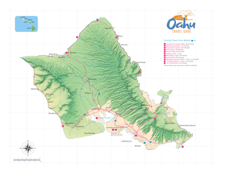
Oahu is two old volcanoes joined by a plain, and that shape explains nearly everything a visitor runs into: which coast is green and which is dry, which shore gets the winter surf, and how long it takes to get anywhere. This map splits the island into six regions on the city’s own planning lines. Tap a region to see what it is like, how far it is from Waikiki, and when to go.
Some links on this page are affiliate links. If you book or buy through them, we may earn a commission at no extra cost to you.
The Six Regions
Oahu, Side by Side
- Waikiki and HonoluluSouth shore · The base for most trips
- East SideSoutheast shore · About 20 min (Hawaiʻi Kai)
- Windward OahuNortheast shore · About 30 min (Kailua)
- North ShoreNorth shore · About 1 hr (Haleʻiwa)
- Central Oahu and Pearl HarborThe saddle · About 45 min (Pearl Harbor)
- West SideLeeward shore · About 35 min (Ko Olina)
How the Island Is Built
Oahu is what is left of two shield volcanoes. The Waiʻanae volcano erupted between about 3.9 and 2.5 million years ago and the Koʻolau between 2.6 and 1.8 million, and erosion has cut each down to a single ridge: the Waiʻanae Range along the west and the Koʻolau Range along the east (USGS). Between them, the central plateau around Wahiawā is the saddle where the two volcanoes met, and a flat coastal plain rings most of the island.
Diamond Head, Koko Crater and Hanauma Bay came much later, from a scatter of small eruptions across the east side; Koko Crater and Hanauma Bay formed about 70,000 to 100,000 years ago (USGS). The high point is Kaʻala in the Waiʻanae Range, at about 4,000 feet. The island is 44 miles long and 30 wide, and no point is more than 10.6 miles from the ocean (State of Hawaii Data Book).
Why One Side Is Green and the Other Is Dry
The trade winds blow from the northeast most of the year. When that moist air hits the Koʻolau cliffs it rises, cools and rains out, which keeps the windward coast and the mountain crest wet. By the time the air crosses to Honolulu and the south shore it has lost most of its water, and the Waiʻanae Range, sitting in the Koʻolau’s rain shadow, gets less still (USGS). Three stations a short drive apart show the effect:
| Station | Side | Rain a year |
|---|---|---|
| Kāneʻohe | Windward | 50.9 in |
| Waikīkī | South shore | 20.7 in |
| Waiʻanae | West side | 17.9 in |
Annual rainfall, NOAA 1991 to 2020 normals (data). Most of it falls from October through April. For month-by-month weather, see the best time to visit Oahu.
For a trip, that means the west side gives you the best odds of sun, Waikiki sits in between, and the windward beaches trade a few passing showers for the greenest scenery on the island.
Which Shore Gets the Surf, and When
Oahu’s surf flips with the seasons. From November through April, swells from the north Pacific hit the north and west shores, and those beaches can get huge, dangerous surf while the south shore goes flat. From May through October it reverses: the north shore is often flat to small, and southern-hemisphere storms send swell into Waikiki. The east and windward shores take rough trade-wind chop year round (Hawaii Ocean Safety).
If you want to watch the big winter waves, read North Shore waves by season. If you want to swim, check whether it is safe to swim today before you pick a beach.
Waikiki and Honolulu
South shore
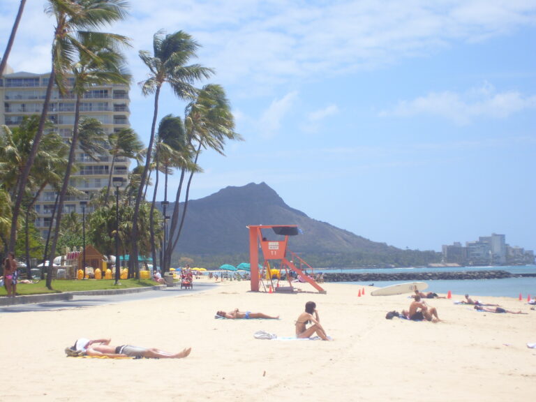
The city side of the island, and the base for most first trips. Waikiki’s hotels line the south shore under Diamond Head; downtown Honolulu, Chinatown and the neighborhoods where residents eat sit a few miles west and inland.
- From Waikiki
- The base for most trips
- Main towns
- Waikīkī, Honolulu
- Rain
- Waikīkī 20.7 in a year
- Surf season
- Summer, May to Oct
Go here for walkable days, the island’s densest food scene, and a base where a car is optional.
Skip it if you want to wake up somewhere quiet, away from a city.
Things to do in Waikiki and Honolulu · Where to stay on Oahu
East Side
Southeast shore
The coast east of Diamond Head: Hawaiʻi Kai’s marina, the Koko Head crater, Hanauma Bay’s reef and the sea cliffs out to Makapuʻu. It sits in the lee of the Koʻolau, so it runs far drier than the windward coast around the corner.
- From Waikiki
- About 20 min (Hawaiʻi Kai)
- Main town
- Hawaiʻi Kai
- Rain
- Paiko Drive 24.8 in a year
- Surf season
- Trade-wind swell year round
Go here for snorkeling at Hanauma Bay and a half day that fits between two Waikiki mornings.
Skip it if you have no Hanauma Bay reservation and do not hike; the bay is the main draw.
Windward Oahu
Northeast shore
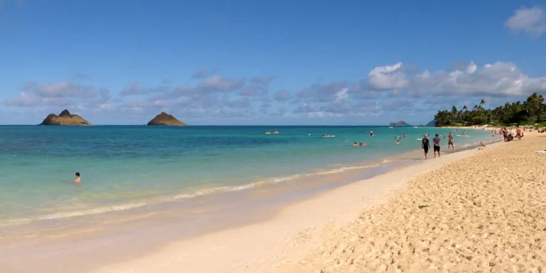
The side the trade winds hit first. Moist air climbs the Koʻolau cliffs and rains out here, which is why Kāneʻohe gets about two and a half times Waikiki’s rain and the valleys stay green. Kailua and Lanikai hold the white-sand beaches; the ranch valleys at Kualoa sit farther up the coast.
- From Waikiki
- About 30 min (Kailua)
- Main towns
- Kailua, Kāneʻohe
- Rain
- Kāneʻohe 50.9 in a year
- Surf season
- Trade-wind chop year round
Go here for beach days at Kailua and Lanikai and the greenest scenery on the island.
Skip it if you need a dry forecast. This is the wettest coast.
North Shore
North shore
Winter surf country. From November the north and west shores take the big swells, and Waimea, Pipeline and Sunset draw crowds to watch from the sand; by summer the same water is often flat to small. Haleʻiwa is the town, about an hour from Waikiki. The city’s North Shore line runs east around Kahuku to Lāʻie.
- From Waikiki
- About 1 hr (Haleʻiwa)
- Main towns
- Haleʻiwa, Kahuku
- Rain
- Kahuku 32.6 in a year
- Surf season
- Winter, Nov to Apr
Go here for watching big-wave surf in winter and a slow day in Haleʻiwa.
Skip it if you want to swim in winter. The surf on this coast is dangerous then.
North Shore map and guide · Things to do on the North Shore · North Shore waves by season
Central Oahu and Pearl Harbor
The saddle
The plateau between the two ranges, where farm fields run up to Wahiawā, with Pearl Harbor at its southern edge. Most visitors cross it on the way to the North Shore. Pearl Harbor and the ʻAiea Loop Trail are the reasons to stop.
- From Waikiki
- About 45 min (Pearl Harbor)
- Main towns
- Wahiawā, ʻAiea
- Rain
- Upper Wahiawā 64.1 in a year
- Surf season
- No surf coast
Go here for Pearl Harbor, a ridge hike, and a stop on the drive north.
Skip it if you are looking for beaches. This is the one region without a surf coast.
Things to do in Central Oahu and Pearl Harbor · Pearl Harbor tickets
West Side
Leeward shore
The dry side. The Waiʻanae Range sits in the Koʻolau’s rain shadow, so Waiʻanae averages under 18 inches of rain a year. Ko Olina’s resort lagoons hold the south end; north of them the coast runs past Mākaha, one of the first big-wave spots, to the end of the road below Kaʻena Point.
- From Waikiki
- About 35 min (Ko Olina)
- Main towns
- Kapolei, Waiʻanae
- Rain
- Waiʻanae 17.9 in a year
- Surf season
- Winter, Nov to Apr
Go here for the best odds of sun, Ko Olina’s lagoons, and quiet beaches.
Skip it if you plan to drive a full circle. The road ends before Kaʻena Point.
Getting Between Regions
Waikiki to the North Shore is roughly an hour’s drive (gohawaii), and each region’s drive time from Waikiki is listed above. Driving the whole way around takes about 100 to 110 miles and 4 to 6 hours without stops, and the road does not quite close the loop: it ends on both sides of Kaʻena Point. The Oahu Drive Map plans the routes between regions, and the Oahu Itinerary Builder turns the regions you pick into days.

Oahu: Full or Half Day Grand Circle Island Tour
★★★★★ 5 · 19,744 reviews · From $100
Check AvailabilityWe may earn a commission if you book through this link, at no extra cost to you.
Oahu Map Questions
How big is Oahu?
Oahu covers about 598 square miles of land and stretches 44 miles at its longest and 30 miles at its widest, with 112 miles of general coastline. It is the third-largest Hawaiian island, after the Big Island and Maui, and no point on it is more than 10.6 miles from the coast.
How long does it take to drive around Oahu?
Plan on about 100 to 110 miles and 4 to 6 hours of driving without stops, which becomes a full day once you stop. It is not a true loop: the road ends on both sides of Kaʻena Point, the island’s western tip, which you reach only on foot.
What is the difference between windward and leeward?
The trade winds blow from the northeast, so windward Oahu is the northeast coast that faces them and leeward Oahu is the south and west, behind the mountains. Moist air rains out as it climbs the Koʻolau Range, so windward Kāneʻohe averages 50.9 inches of rain a year while Waikīkī gets 20.7 and Waiʻanae 17.9.
Which side of Oahu is the sunniest?
The west side is the driest. The Waiʻanae Range sits in the Koʻolau’s rain shadow, and NOAA normals put Waiʻanae at 17.9 inches of rain a year and Kalaeloa, near Ko Olina, at 13.9, against 50.9 in Kāneʻohe.
Is Honolulu on Oahu?
Yes. Honolulu, the state capital, is on Oahu, and the City and County of Honolulu governs the whole island. The city proper, the Census Bureau’s Urban Honolulu, covers about 60.6 square miles of the south shore.
Which side of Oahu is best to stay on?
Waikiki is the only base where a car is optional; Ko Olina, the North Shore and Kailua each effectively require one. Our guide to where to stay on Oahu compares all four.