
Parks · Waiʻanae Coast
Mākaha Beach and the Waiʻanae Coast Drive
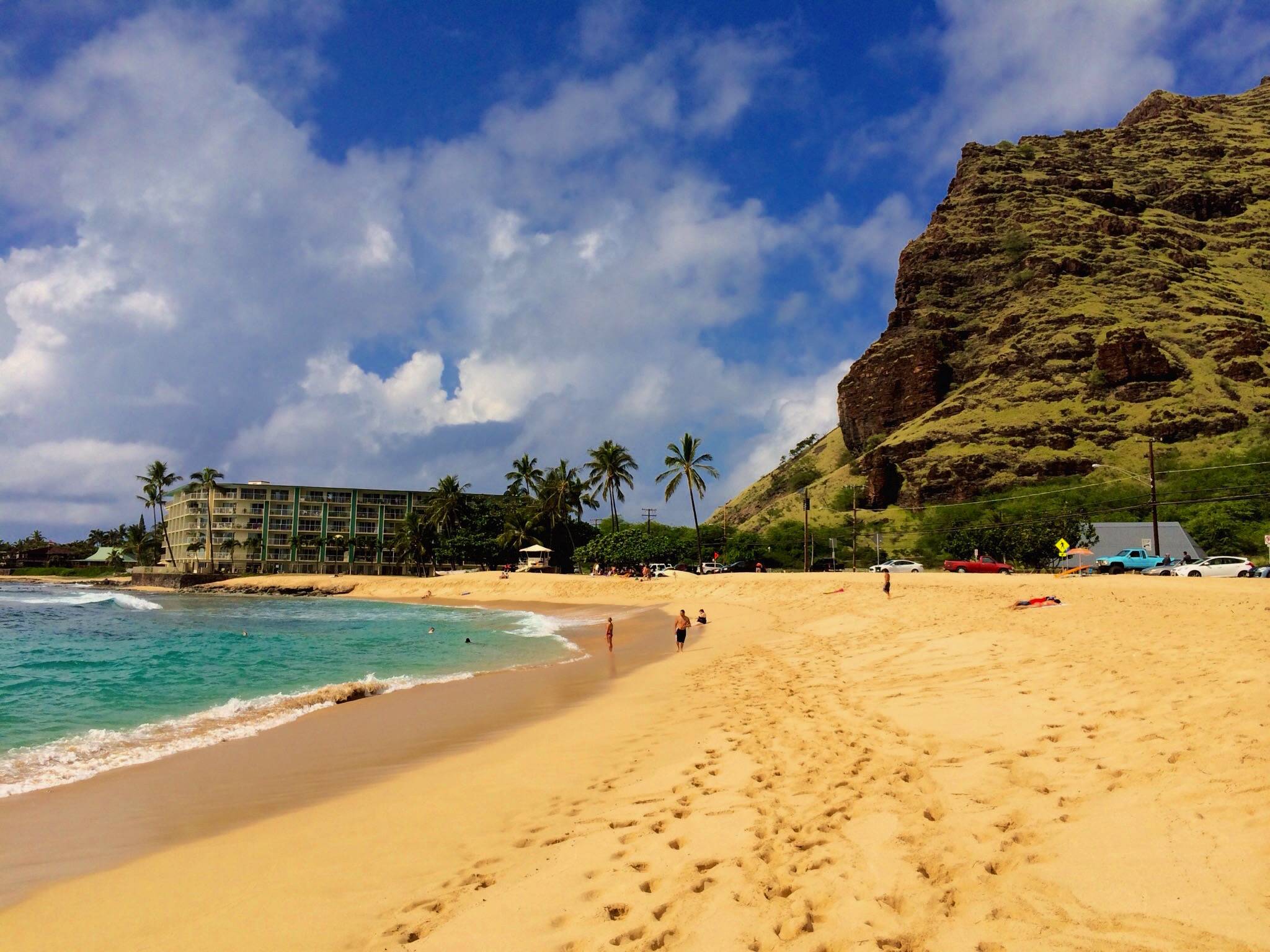
Mākaha Beach Park is the City’s 20-acre beach park where surfers began riding big waves in Hawaiʻi, about 40 miles and 70 minutes from Waikīkī on Farrington Highway. Here are the lifeguard hours, the winter surf, where to park and the surf history, then the drive up the coast from Kapolei stop by stop, and how to visit a residential, largely Native Hawaiian community.
Some links on this page are affiliate links. If you book or buy through them, we may earn a commission at no extra cost to you.
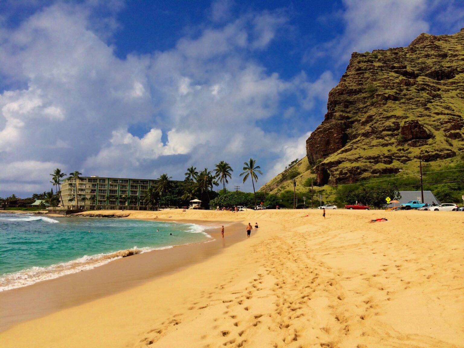
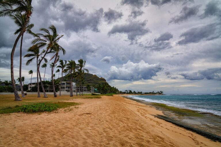
Mākaha Beach Park from the sand. Photo: Nicolai Edgar Andersen, CC BY-SA 4.0, via Wikimedia Commons.
Quick Answer
Honolulu Ocean Safety staffs Towers 47A and 47B, 8 a.m. to 6:30 p.m. daily. From November through April west shores see extremely high surf, and Ocean Safety lists Mākaha among Oʻahu’s common shorebreak beaches, so plan to watch the waves in winter and swim on calm summer days. Farrington Highway runs through the park, with the parking lot on the inland side and the beach across the road. From Waikīkī it is about 40 miles and 70 minutes without traffic, by our routing. Take your trash out, lock the car and leave nothing in view.
- Hours
- Not on the City’s closure-hours list; call DPR at (808) 768-3003
- Lifeguards
- Towers 47A and 47B, 8 a.m. to 6:30 p.m. daily
- Parking
- A lot on the inland (mauka) side of the highway; no City page gives a stall count or fee
- Size
- About 20.6 acres, split in two by Farrington Highway
- Facilities
- Restrooms, showers, picnic areas and shade; a canoe hālau on the inland side
- Rules
- No alcohol, dogs, smoking, fire pits, fireworks or amplified music; no diving or cliff jumping
- Bus
- TheBus Route 40, Ala Moana Center to Mākaha
- From Waikīkī
- About 40 miles, 70 minutes without traffic (our routing)
- Managed by
- City Department of Parks and Recreation
Facts from the City’s park, tower and closure pages, its parks data layer, a 2021 House resolution, SafeBeachDay and the HTA, checked Oct 25, 2026.
Why Surfers Know Mākaha
Hawaiʻi Magazine traces Mākaha’s surfing story to fall 1937. John Kelly and Wally Froiseth drove a Model T out to hunt lobster, camped on the beach and woke to the sound of big waves. When they described the break, the magazine says, “nobody believed them.” The magazine gives the name’s meaning as “fierce, savage or ferocious” (Hawaiʻi Magazine, Kevin Allen). The Hawaii Tourism Authority calls it one of the first places where surfers began big-wave surfing (gohawaii.com).
The Mākaha International Surfing Championships, organized by the Waiʻanae Lions Club and the Waikīkī Surf Club, was the first international surf contest held in Hawaiʻi, and in 1962 it became the first televised surf contest, on ABC’s “Wide World of Sports” (Hawaiʻi Magazine). The World Surf League says it was “dubbed the unofficial World Championships” (WSL). The two sources disagree on when it began and ended (Hawaiʻi Magazine says 1953 to 1973, the WSL says 1954 to 1971), so we give no years beyond 1962.
Surfing still runs the beach. A 2021 House resolution names Richard “Buffalo” Keaulana, Rell Sunn, Sunny Garcia, Rusty Keaulana and Duane DeSoto as champions from the park, and lists contests held there: Buffalo’s Big Board Surfing Classic, Rell Sunn’s Menehune Surf Meet, Bradah Mel’s Waterman’s Championships and the Keiki Surf Kontest. It adds that the City lists Mākaha every year among the ten most visited parks on Oʻahu (H.R. 149, 2021). Hawaiʻi Magazine put the 2020 Big Board Classic on February 22 and 23; confirm the dates before you plan around it.
Winter Surf, Shorebreak and Lifeguards
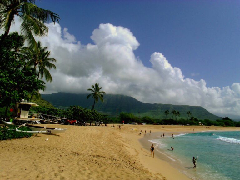
Honolulu Ocean Safety staffs Tower 47A (84-369 Farrington Highway) and Tower 47B (84-277 Farrington Highway) from 8 a.m. to 6:30 p.m. daily (Ocean Safety). After 6:30 no one is on duty. Ocean Safety lists Mākaha with Sandy Beach, Waimea Bay, ʻEhukai and Makapuʻu as “common shorebreak beaches,” and posts Shark Sighted and No Swimming signs when conditions call for them (beach signs). Do not enter the water where one is posted.
Winter is the big-wave season. Ocean Safety says to expect “extremely high surf at many north and west shore beaches” from November through April, and calmer water on all beaches from May through October, though north swells can wrap around to west shores in summer too (Hawaii’s surf seasons). SafeBeachDay, the beach-hazard site built with the City, the Hawaii Lifeguard Association and the state Department of Health, puts winter waves at about 25 feet off Mākaha Point and warns of powerful backwash and rip currents when the surf is up. Its hazard list: dangerous shorebreak, high surf, jellyfish, rip currents, sharks, sharp coral and strong currents. It also says lifeguards are not always on duty. The HTA adds that the sloping sand at the beachhead can cause strong backwash that catches visitors off guard.
In practice: from November through April, watch from the sand. In summer, swim in front of the towers on a calm day and ask a lifeguard first. Check current surf and warnings at Hawaii Ocean Safety, and read our guide to swimming safely on Oʻahu for the general rules.
The Beach, the Restrooms and the Highway Between Them
The City’s parks data layer gives the park about 20.6 acres, with restrooms, showers, picnic areas and shade (City GIS). A 2021 House resolution says Farrington Highway splits the park in two: the beach is on the ocean (makai) side, and the restrooms, showers, parking lot and a canoe hālau are on the inland (mauka) side. It calls the crossing unsafe, “particularly” for small children, so drive slowly through the park and walk children across (H.R. 149).
The highway and the beach have been fighting for the same ground. The resolution says storms and waves damaged the road in 1983, a 1998 City master plan to move the highway inland was never funded, and a 2010 study found the erosion “poses a serious safety concern.” State emergency permits have let crews move sand from the east end of the beach to the west end (H.R. 149). In March 2025 the state Department of Transportation repaired a 200-foot stretch of eroded shoulder on Farrington Highway near Keaʻau Beach, and officials were weighing an inland route estimated at $70 million to $100 million (Hawaii News Now).
No City page we found gives Mākaha’s parking stall count or a fee, and the City’s closure-hours list leaves Mākaha Beach Park off. The neighboring beach parks on it close from 10 p.m. to 5 a.m., and Keaʻau closes at 8 p.m. Call DPR at (808) 768-3003 for Mākaha’s hours.
Getting There and Where to Park
Driving: from central Waikīkī it is about 40 miles and 70 minutes to the park without traffic, by our calculation (OSRM routing, October 2026). H-1 west becomes Farrington Highway (Route 93) at Kapolei (DLNR), and from Kapolei it is 17 miles and 38 minutes more. Our Kapolei guide covers the town where the drive starts, and Ko Olina sits just off the highway before the first beach park. Add time for traffic.
Parking: use the lot on the inland side of the highway, the one the House resolution places with the restrooms and canoe hālau, and cross at the park. Do not park on the highway shoulder: the highway is busy, and children cross it to reach the beach.
Closures: news coverage calls Farrington Highway the only road in and out for this community (Hawaii News Now), so a closure stops everyone. Check the state Department of Transportation’s traffic updates before you leave.
TheBus: Route 40 runs between Ala Moana Center and Mākaha (timetable). Check the current timetable before you plan around it. Our car rental guide covers the other option.
Rental car
Driving the Waiʻanae Coast
Mākaha is about 40 miles and 70 minutes from Waikīkī, and the stops along Farrington Highway are easier with your own car. Compare rental rates before you book. Compare Oahu rental cars on DiscoverCars.
We may earn a commission if you book through this link, at no extra cost to you.
The Farrington Highway Drive, Stop by Stop
The seven stops in the table below, numbered the same way, at the City’s park points; Yokohama Bay is the beach as OpenStreetMap draws it. Map data © OpenStreetMap contributors.
From Kapolei the drive to the end of the pavement past Yokohama Bay is 22.8 miles and 50 minutes without stops or traffic, by our routing. Every stop below is a City beach park with its own lifeguard tower except Keaʻau, so stop at a tower, not between them. Times are from Kapolei Hale.
| Stop | From Kapolei (our routing) | Ocean Safety tower | City park notes |
|---|---|---|---|
| 1. Kahe Point Beach Park (Electric Beach) | 6.2 mi, 12 min | Tower 40, 92-301 Farrington Hwy | 4.5 acres; closes 10 p.m. to 5 a.m. |
| 2. Kalanianaʻole Beach Park (Nānākuli) | 8.4 mi, 16 min | Tower 41, 89-269 Farrington Hwy | 39.6 acres; closes 10 p.m. to 5 a.m. |
| 3. Māʻili Beach Park | 12.1 mi, 24 min | Towers 43A and 43B, 87-210 and 87-225 | 39.6 acres; closes 10 p.m. to 5 a.m. |
| 4. Pōkaʻī Bay Beach Park | 13.9 mi, 29 min | Tower 45, 85-923 Bayview St | 15.5 acres; closes 10 p.m. to 5 a.m. |
| 5. Mākaha Beach Park | 17.2 mi, 38 min | Towers 47A and 47B | 20.6 acres; hours not on the City list |
| 6. Keaʻau Beach Park | 18.1 mi, 40 min | None on the tower list | 38.0 acres; closes 8 p.m. to 5 a.m. |
| 7. Yokohama Bay (Keawaʻula) | 22.8 mi, 50 min to the road end | Tower 50, 81-601 Farrington Hwy | State park; DLNR trail notice below |
Kahe Point. Kahe Point Beach Park is the snorkel spot locals call Electric Beach, for the power plant next door. Hawaiʻi Magazine says snorkeling there is “recommended for strong swimmers only” (Hawaiʻi Magazine, Aug 2025). Ocean Safety installed Tower 40 on August 3, 2023, and its lifeguards made seven rescues in the first month, with large groups of divers and snorkelers facing strong currents (City release). On September 26, 2022, six visitors snorkeling there, two of them children, were swept offshore and reached shore uninjured (City release). Our Hanauma Bay alternatives and Oʻahu snorkeling guide compare it with calmer spots.
Nānākuli and Māʻili. The City’s directory lists Kalanianaʻole Beach Park as “formerly Nānākuli” (DPR), and its closure list names four sections: Forac, Zablan, Black Rock and Cove Beach. Ulehawa Beach Park next door has Tower 42. Māʻili Beach Park covers about 39.6 acres on the City’s data layer and has two towers.
Pōkaʻī Bay. Pōkaʻī Bay Beach Park sits beside the Waiʻanae Small Boat Harbor, which DLNR lists at 85-491 Farrington Highway with 109 berths and 7 boat ramps (DOBOR); DLNR’s Oʻahu facilities list puts the two side by side (DLNR). A state health specialist told Civil Beat in 2018 that people swim in the bay because the water is “nice and calm” and that the department tests it monthly (Civil Beat). Check the state’s water quality map after heavy rain.
Mākaha and Keaʻau. Mākaha Beach Park is the stop above. Keaʻau Beach Park comes about a mile later; it has no tower on Ocean Safety’s list and the City closes it two hours earlier than its neighbors.
Yokohama Bay. The pavement ends past Yokohama Bay, where the Keawaʻula section of Kaʻena Point State Park begins. DLNR’s notice dated November 12, 2026 says the Keawaʻula trail to Kaʻena Point remains closed, vehicle access is restricted past the restroom parking lot and the comfort station has reopened. The same notice says Kaʻena Point State Park vehicle access has reopened (DLNR notices). Check it before you drive out. Our Kaʻena Point State Park guide covers the point.
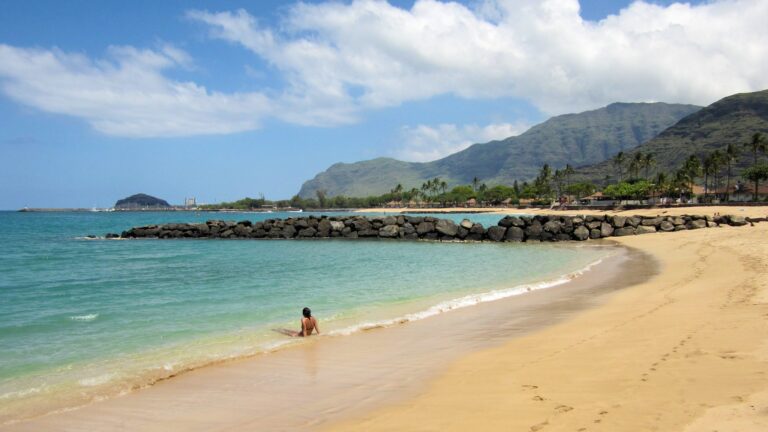
From the water. West Oʻahu dolphin and snorkel sails run from the coast’s harbors. Federal rules require tour boats and their passengers to stay at least 50 yards from Hawaiian spinner dolphins (NOAA Fisheries), so pick a trip that watches dolphins from the boat. The one below checks in at Ko Olina Marina, per its Viator listing.

Ko Olina Dolphin Watch and Snorkel Sail with Lunch
★★★★★ 4.5 · 335 reviews · From $140
Check AvailabilityWe may earn a commission if you book through this link, at no extra cost to you.
Visiting a Residential Coast: Respect and Rules
This is home. The Waiʻanae Coast is a residential community, not a resort district, and home to one of Oʻahu’s largest Native Hawaiian communities (Civil Beat). The Hawaii Tourism Authority describes a slower pace than Waikīkī and tells visitors to follow “leave no trace” practices and pack out everything they bring (gohawaii.com). Say hello, drive slowly through neighborhoods and give surf contests and canoe crews room.
Park legally and take your trash out. Use the lots and obey the hours above. The City bans alcohol in all its parks: “Possessing alcoholic beverages is prohibited in all parks” (City rules). SafeBeachDay adds no dogs, amplified music, fire pits, fireworks, smoking, diving or cliff jumping at Mākaha.
Lock the car and leave nothing in view. HPD tells visitors to lock car doors and not to leave “packages or bags in plain view” (HPD). It is generic advice for any Oʻahu lot. Specific to this coast, Kahe Point lifeguards asked police for help with car break-ins in the tower’s first month (City release). Take valuables with you or leave them at the hotel.
Follow closure signs. The City has fenced off stretches of Waiʻanae Coast beach parks for cleanup under its Stored Property Ordinance, including a third of a mile of Mauna Lahilahi Beach Park in Mākaha from February 6 to 20, 2026 (DPR) and part of Ulehawa Beach Park from May 9 to 23, 2025 (DPR). Both notices let people walk through to the ocean and not stay. If you meet fencing, follow it, and give the people and belongings you pass in any park the privacy you would give a neighbor.
Give wildlife room. NOAA tells swimmers approached by spinner dolphins to make “no effort to engage or pursue” them and to move away. Three swimmers, two residents and one visitor, paid summary settlements for pursuing a pod off Mākua Beach, farther up the coast (NOAA). The HTA calls Kaʻena Point a sacred spot and says to stay on the trail there. For other beaches, see our best beaches on Oʻahu and things to do on Oʻahu.
Mākaha Beach and the Waiʻanae Coast Questions
Is Mākaha Beach safe to swim?
In summer, on a calm day, in front of the towers, after asking a lifeguard. In winter the surf is high: Ocean Safety lists Mākaha among Oʻahu’s common shorebreak beaches, and SafeBeachDay puts winter waves at about 25 feet off Mākaha Point.
Are there lifeguards at Mākaha Beach Park?
Yes. Honolulu Ocean Safety staffs Towers 47A and 47B from 8 a.m. to 6:30 p.m. daily.
Where do you park at Mākaha Beach Park?
In the lot on the inland side of Farrington Highway. The City gives no stall count or fee. Do not park on the highway shoulder.
How far is Mākaha from Waikīkī?
About 40 miles and 70 minutes without traffic by our routing. From Kapolei it is 17 miles and 38 minutes.
What were the Mākaha International Surfing Championships?
The first international surf contest held in Hawaiʻi, organized by the Waiʻanae Lions Club and the Waikīkī Surf Club, and the first televised surf contest, on ABC in 1962. Sources disagree on its start and end years.
What are the stops on the Waiʻanae Coast drive?
Kahe Point (Electric Beach), Kalanianaʻole Beach Park in Nānākuli, Māʻili, Pōkaʻī Bay, Mākaha, Keaʻau and Yokohama Bay, where the pavement ends. The whole drive from Kapolei is 22.8 miles and about 50 minutes without stops.
Can I walk to Kaʻena Point from Yokohama Bay?
Not right now. DLNR’s November 12, 2026 notice says the Keawaʻula trail remains closed. Check the notice before you go.
How should visitors behave on the Waiʻanae Coast?
Park in the lots, take your trash out, lock the car with nothing in view, follow closure signs and give residents space. It is a residential, largely Native Hawaiian community.
Sources, checked Oct 25, 2026
- Lifeguard tower locations and hours (Honolulu Ocean Safety)
- Understanding beach signs (Honolulu Ocean Safety)
- Park closure hours (City DPR)
- City park directory (DPR)
- City parks amenities layer (City GIS)
- Camping rules, alcohol in parks (City DPR)
- Mauna Lahilahi Beach Park partial closure (City DPR, Feb 2026)
- Ulehawa Beach Park partial closure (City DPR, Apr 28, 2025)
- Kahe Point tower first month (City Emergency Services, Sep 2, 2023)
- Kahe Point snorkeler rescue (City Emergency Services, Sep 26, 2022)
- Snorkeling at Electric Beach (Hawaiʻi Magazine, Aug 25, 2025)
- H.R. 149, Farrington Highway at Mākaha Beach Park (Hawaii House, 2021)
- How Mākaha helped revolutionize Hawaiʻi’s surf culture (Hawaiʻi Magazine)
- Vans Triple Crown history (World Surf League, Nov 5, 2014)
- Makaha Beach Park (SafeBeachDay)
- Mākaha Beach (gohawaii.com)
- Leeward Coast (gohawaii.com)
- Hawaii’s surf seasons (Hawaii Ocean Safety)
- Hawaii Ocean Safety conditions
- Coastal erosion repairs on Farrington Highway (Hawaii News Now, Mar 30, 2025)
- Important park notices (DLNR State Parks, Nov 12, 2026 entry)
- Kaʻena Point trail and Farrington Highway directions (DLNR State Parks)
- Waiʻanae Small Boat Harbor (DLNR DOBOR)
- Oʻahu boating facilities (DLNR)
- Pōkaʻī Bay beach park restrooms and water (Civil Beat, Apr 9, 2018)
- Water quality advisories (Hawaii Department of Health)
- Fact check: Waiʻanae has the most Native Hawaiians (Civil Beat, Nov 1, 2011; 2010 Census)
- Visitor information (Honolulu Police Department)
- Swimming and approaching spinner dolphins, Q and A (NOAA Fisheries, Sep 30, 2022)
- Snorkelers fined for pursuing spinner dolphins (NOAA Fisheries, Sep 28, 2021)
- TheBus Route 40 timetable
- Drive times, our calculation (OSRM, Oct 25, 2026)
Researched from the sources above, checked Oct 25, 2026. We never claim a visit we did not make; first-hand notes are marked as Stew’s. How we research and review.

Leave a Reply