
Hike · Mokulēʻia and Waiʻanae
Kaʻena Point State Park: Trail, Rules and Wildlife
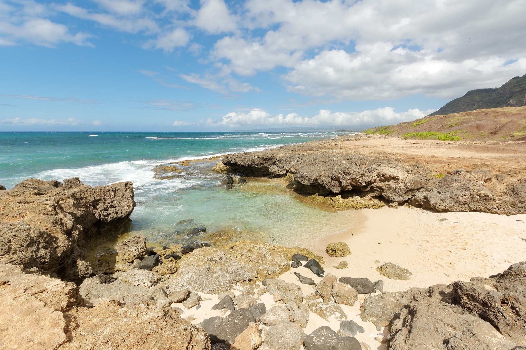
Kaʻena Point is the western tip of Oʻahu, a 2.5-mile walk from the end of the road on either side, through a seabird reserve with no dogs, no water and almost no shade. As of October 13, 2026 the Waiʻanae-side trail at Yokohama Bay is closed after the September storms, so Mokulēʻia is the way in. Here is which side to pick, what the State enforces, and how to behave around albatross, monk seals and the surf.
Some links on this page are affiliate links. If you book or buy through them, we may earn a commission at no extra cost to you.
Quick Answer
Walk in from Mokulēʻia, where the pavement ends past Waialua. DLNR’s October 8 notice lists the Keawaʻula trail at Yokohama Bay as closed. Either trail is about 2.5 miles one way, and DLNR says allow 1 to 3 hours. The park is open 6 a.m. to 7 p.m. and neither side has drinking water. No dogs, stay on the trail, give monk seals 50 feet, and stay out of the water.
Kaʻena Point at a Glance
The park is the gateway to the Natural Area Reserve at the point (DLNR). The reserve dates to 1983 and protects one of the last intact dune ecosystems in the main Hawaiian Islands. Hawaiian tradition knows the point as leina a kaʻuhane, the “leaping place of souls” (DOFAW brochure). The trail is an old railroad bed and dirt road (DLNR), and the only way to the point is on foot (gohawaii.com); the reserve also allows bicycles.
| Detail | Kaʻena Point State Park |
|---|---|
| Where | Northwest tip of Oʻahu; one State park in two sections, Mokulēʻia and Keawaʻula |
| Hours | Daily 6:00 a.m. to 7:00 p.m. |
| Distance and time | About 2.5 miles one way from either trailhead, then back the same way. DLNR: allow 1 to 3 hours |
| Ground and shade | Dirt road, sand and rock; hot and dry with little shade |
| Water and services | No drinking water on either side; no restrooms or lifeguards at Mokulēʻia |
| Not allowed | Dogs (even leashed), drones, camping, alcohol, smoking, open fires |
Two Ways In: Mokulēʻia or Keawaʻula (Yokohama Bay)
The two trailheads sit on opposite sides of the point, on separate roads. DLNR’s directions to Mokulēʻia are H-2 to Kaukonahua Road, then Farrington Highway (Route 930) past Waialua, about a mile beyond Camp Erdman (DLNR). The drive times are our own (OSRM), so add time for traffic.
DLNR’s October 8 notice, written for the Hurricane Nolo and Hurricane Lowell recovery, says the Keawaʻula trail “remains CLOSED” (DLNR notices). It lists no closure of the Mokulēʻia walk. Vehicle access past the Mokulēʻia gate is murkier: the park page says the road reopened to permit holders on October 6, and the notices page says it closed on October 8 (DLNR park page). Check both the morning you go.
| Detail | Mokulēʻia (North Shore side) | Keawaʻula (Waiʻanae side) |
|---|---|---|
| Starts at | Where the pavement ends past Waialua and Camp Erdman | Where the pavement ends past Yokohama Bay |
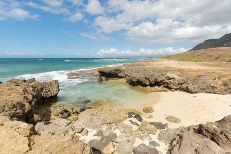
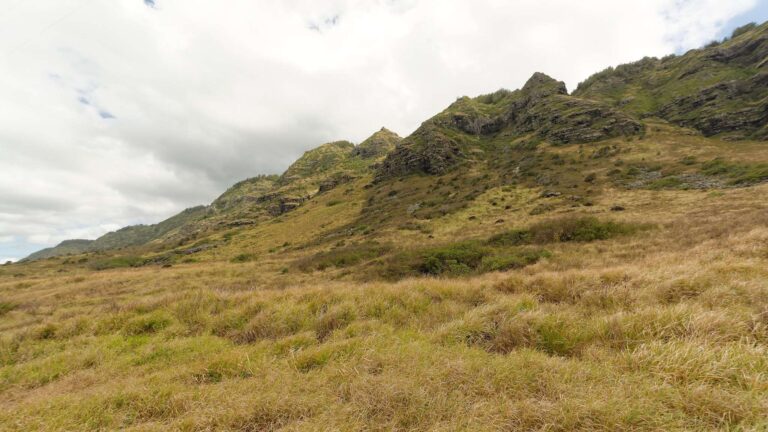
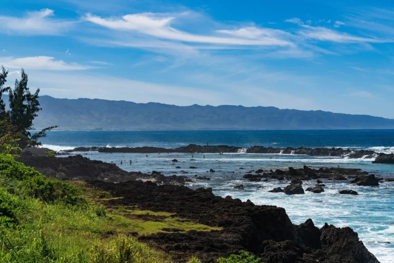
| Ground | Dirt road over a broad, relatively flat coastal plain, with a limestone reef and sand dunes | Dirt road along the shore: boulder beaches, tide pools, two small blowholes midway, and places where the old road has washed out |
| Facilities | No restrooms or lifeguards | Comfort station down; portable toilets (Oct 8 notice) |
| Status, Oct 13 | No closure listed for walkers | Trail CLOSED (DLNR notices, Sep 14 and Oct 8) |
| Drive from Waikīkī, our routing | About 41 miles, 70 minutes without traffic | About 46 miles, 83 minutes without traffic |
Which Side to Choose
Pick Mokulēʻia. Right now it is the only open choice, and even after Keawaʻula reopens it is the easier first walk: DLNR describes a flat coastal plain, while the Waiʻanae side runs along boulder beaches where the road has eroded.
- First visit or kids: Mokulēʻia, with a plan for sun, wind and water.
- Cyclists: either side; the reserve allows foot and bicycle travel only (State Parks record).
- Shoreline walkers: Keawaʻula, once DLNR reopens it, for the boulder beaches and blowholes.
- Staying on the Waiʻanae coast: Keawaʻula is 6.5 miles and 14 minutes from Makaha by our routing, but Mokulēʻia is the open trail.
- Guided walks: none; tours in the reserve need a special use permit (DOFAW).
Rental car
The easiest way to the trailhead
Both trailheads are more than an hour from Waikīkī by our routing, at the end of a road with no services. Compare Oahu rental cars on DiscoverCars.
We may earn a commission if you book through this link, at no extra cost to you.
The Rules DLNR Enforces
Hours: 6 a.m. to 7 p.m. From 7 p.m. to 6 a.m. there is no stopping or parking from the Dillingham airfield entrance to the vehicle gate (DLNR).
No dogs, not even on a leash. DLNR says they frighten nesting birds and have caused mass deaths of seabirds (DLNR, 2019). Only service animals may enter (DLNR trail page).
Stay on the trail. No drones, open fires, camping, smoking or alcohol, and pack out what you pack in (State Parks record). Report violations to 643-DLNR (DLNR rules).
Vehicles: motor vehicles are prohibited in the reserve, and driving the road past the Mokulēʻia gate takes a State permit with a 2026 Gold decal. Walking in needs none of that. A predator-proof fence built in 2011 encloses 59 acres to keep cats, rats and mongoose away from the nests.
Albatross, Shearwaters and Monk Seals
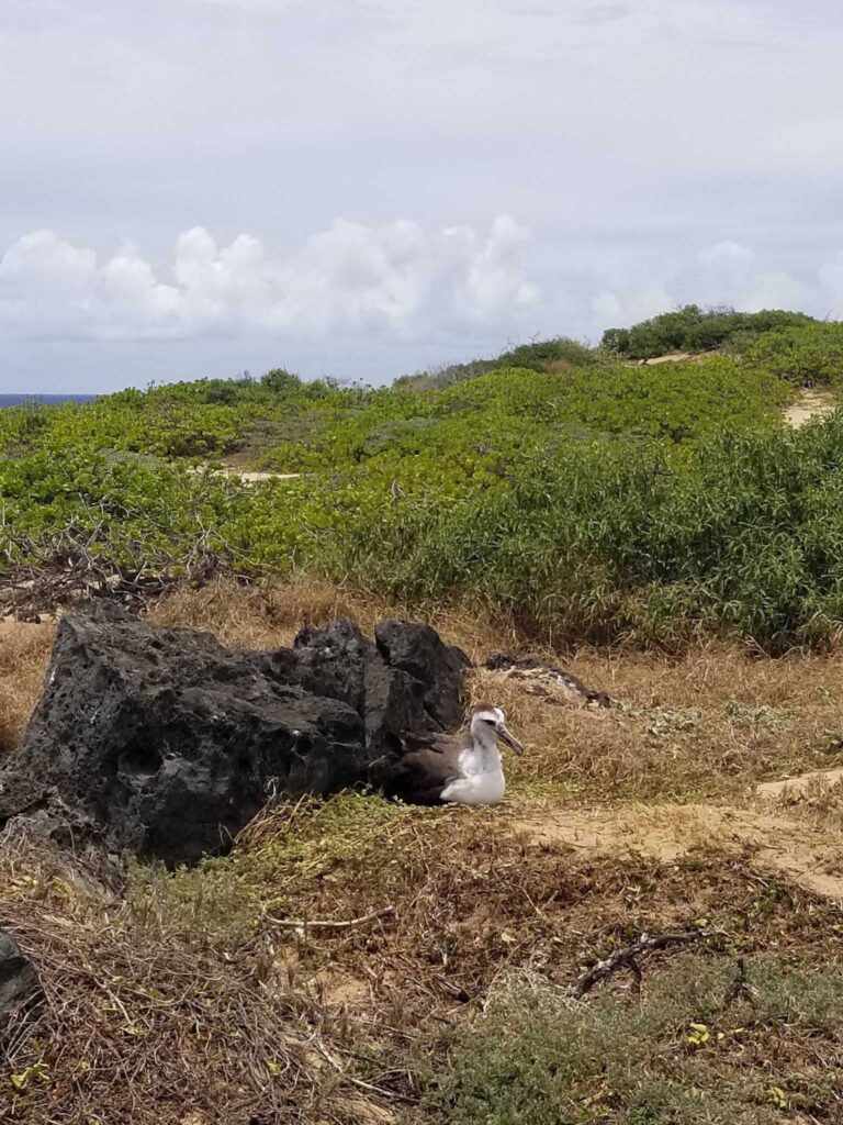
Albatross (mōlī). Laysan albatross nest on open ground. DLNR says courtship starts “usually middle to late fall” (DOFAW). Its 2019 release says egg-laying began at the start of December and counts 106 pairs trying to breed in 2018 (DLNR). Stay on the marked trail, watch from a distance and respect posted signs. DLNR gives no foot distance, so if a bird reacts to you, back off.
Shearwaters (ʻuaʻu kani). They nest in burrows in the dunes (DLNR). Leave the trail and you might step through a burrow, hurting yourself and the bird inside (DOFAW).
Monk seals. They visit the reserve regularly (DLNR). DLNR and NOAA both say 50 feet on land and in the water; NOAA says 150 feet for a mother and pup (NOAA Fisheries). Offshore, spinner dolphins get 50 yards.
Ocean, Heat and Tide Pools
DLNR lists falling rocks, dangerous shorebreak and strong current as the hazards (State Parks record) and says to stay away from the wave-exposed coast (DLNR). The tide pools at Mokulēʻia sit on that coast, and there are no lifeguards. The state tourism site calls water activities there “extremely dangerous” and “highly discouraged” (gohawaii.com). Keawaʻula allows swimming “only during calm conditions in the summer” (DLNR).
Winter brings extremely high surf to many north and west shore beaches, and north swells can wrap to western shores in summer (Hawaii Ocean Safety). Our guide to whether it is safe to swim on Oʻahu today covers how to read a day. On land the problem is heat: DLNR says hat, sunscreen and plenty of water.

Luxury Snorkel Cruise with Dolphin Watch and Hawaiian Meal
★★★★★ 4.7 · 1,505 reviews · From $174
Check AvailabilityWe may earn a commission if you book through this link, at no extra cost to you.
Parking and Car Break-Ins
We found no published break-in count for either lot, so we are not calling Kaʻena a hot spot. The State and the police give the same island-wide advice: lock your car and take valuables with you (DOFAW), and keep bags out of plain view (HPD). Park where the pavement ends, and not on the road after 7 p.m.
Nearby: Yokohama Bay, Makaha, Mokulēʻia and Dillingham
Yokohama Bay is the common name for the beach at the Waiʻanae end of the park; DLNR lists board and body surfing for experts and swimming only in calm summer water. Makaha Beach Park is the next beach south. On the Mokulēʻia side you pass Mokulēʻia Beach Park and Dillingham Airfield, and Haleʻiwa is about 22 minutes from the trailhead by our routing.
Our North Shore guide covers that coast, with Shark’s Cove, Turtle Beach and the food trucks for after the walk. The things to do on Oʻahu guide has the rest of the island.
Should You Go? By Traveler Type
Go if a flat, exposed 5-mile round trip to a seabird colony sounds like a good morning. Skip it for a beach, shade or an easy lookout.
- Hikers and wildlife watchers: yes, from Mokulēʻia, in late fall and winter for the most birds.
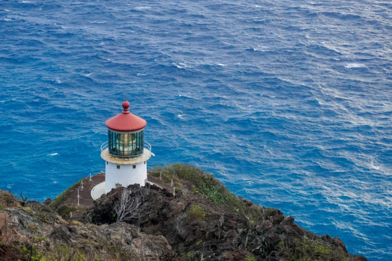
- Families: yes if the kids can walk 5 miles in the sun. Otherwise try the Makapuʻu Lighthouse Trail, a 2-mile round trip.
- Beach and swim travelers: no; the east side drive has gentler stops.
- Short on time: probably not; it is over an hour each way from Waikīkī. The Aiea Loop Trail is closer.
- Anyone with a dog: no, even on a leash.
Kaʻena Point: Questions
Is the Kaʻena Point trail open?
DLNR lists the Keawaʻula (Yokohama Bay) trail as closed as of October 8, 2026 and lists no closure for the Mokulēʻia walk. Check the State Parks page before you go.
How long is the hike?
About 2.5 miles one way from either trailhead, per DLNR, who say to allow 1 to 3 hours.
Can you drive to Kaʻena Point?
Not past the gate without a State permit, and motor vehicles are prohibited in the reserve.
Are dogs allowed?
No. Only service animals, and DLNR says dogs are illegal even on a leash.
Is there water or a restroom?
No drinking water on either side and no restrooms at Mokulēʻia.
Can you swim at Kaʻena Point?
No. DLNR lists dangerous shorebreak and strong current.
Sources, checked Oct 13, 2026
- Kaʻena Point State Park (DLNR State Parks)
- Kaʻena Point Trail (DLNR State Parks)
- Vehicle access permit (DLNR State Parks)
- Important Park Notices, Oct 8, 2026 (DLNR State Parks)
- Park Rules (DLNR State Parks)
- Trail hazards and prohibited items (State Parks data)
- Kaʻena Point Natural Area Reserve (DLNR DOFAW)
- Reserve brochure, rev. 2005 (DLNR DOFAW)
- Albatross record year (DLNR news release, Feb 5, 2019)
- Viewing marine wildlife (NOAA Fisheries)
- Hawaii’s surf seasons (Hawaii Ocean Safety)
- Kaʻena Point (gohawaii.com)
- Visitor information (Honolulu Police Department)
- Drive times, our calculation (OSRM, Oct 13, 2026)
- Trail route (OpenStreetMap, ODbL)
Researched from the sources above, checked Oct 13, 2026. We never claim a visit we did not make; first-hand notes are marked as Stew’s. How we research and review.
Leave a Reply