
Hikes · Central Oahu
ʻAiea Loop Trail and Keaīwa Heiau
The ʻAiea Loop Trail is a 4.8-mile ridge loop in the hills above Pearl Harbor, starting and ending at Keaīwa Heiau State Recreation Area, about 12 miles from Waikiki. It takes 2.5 to 3 hours and costs nothing. A healing heiau sits at the park entrance, and the wreckage of a 1944 bomber lies near the high point. Here is how to get there, what the trail is like, and how to pair it with a Pearl Harbor day.
Some links on this page are affiliate links. If you book or buy through them, we may earn a commission at no extra cost to you.
Most visitors see ʻAiea only from the H-1 on the way to Pearl Harbor. Three miles up the hill, the road ends at a 384-acre state park with a forested ridge trail, a Hawaiian healing temple and views back down over Puʻuloa, the harbor.
The Trail in One Pass
ʻAiea Loop Trail Quick Facts
| Where | End of ʻAiea Heights Drive, about 12 miles from Waikiki |
| Hours | 7 a.m. to 7:45 p.m. (Apr 1 to Labor Day); 7 a.m. to 6:45 p.m. the rest of the year |
| Cost | Free entry and parking |
| Trail | 4.8-mile loop, 900 ft elevation gain, 2.5 to 3 hours |
| Terrain | Gradual climbs, one steep switchback, a stream crossing, mud and roots |
| Restrooms | Yes, near the picnic areas |
| Dogs | Leashed, on the trail only |
| Bus | No route reaches the park |
| Camping | Temporarily closed |
How to Get to the ʻAiea Loop Trail
From Waikiki, take the H-1 west to the Moanalua Freeway (Route 78), exit at the ʻAiea cutoff, and turn right at the third traffic light onto ʻAiea Heights Drive. Follow it about 3 miles to the end of the road. Keaīwa Heiau is at the park entrance; keep driving the paved park road past the picnic areas and campground to the trailhead. Parking along the road is free.
No bus gets you there. TheBus Route 551 climbs ʻAiea Heights Drive, but its last stop, at Hoapono Place, is well below the park, and the rest is an uphill walk along the road. This is a hike you drive to. Our guide to renting a car on Oahu covers where to pick one up.
Rental Car
Compare Oahu Rental Rates
DiscoverCars searches the island’s rental agencies in one go. Compare Oahu rental cars on DiscoverCars.
We may earn a commission if you book through this link, at no extra cost to you.
The Loop: What the Hike Is Like
The loop runs 4.8 miles along the forested ridge on the west side of Hālawa Valley, and the state’s trail page lists 900 feet of elevation gain and says to allow 2.5 to 3 hours. In its words, the hike “is not strenuous but involves some gradual uphill climbs with a steep switchback and stream crossing at the end of the trail.” Expect mud and exposed tree roots, especially after rain.
The lower trail runs through lemon eucalyptus and Norfolk Island pines, much of it replanted in the late 1920s; crush a eucalyptus leaf for the citrus smell. Near Puʻu ʻUau, the high point about halfway around, native koa and ʻōhiʻa take over. From the open stretches you look out over Pearl Harbor, the Waiʻanae Range, Honolulu and Diamond Head. Hikers also point out the H-3 freeway cutting through the Koʻolau on the far side of the valley.
There is no waterfall on this trail, whatever the search results suggest. The only water is the stream crossing near the end.
The map at the top of this page traces the loop from OpenStreetMap. For the state’s own version, with both trailheads and the park roads, see the official park and trail map (PDF) from State Parks.
The B-24 Bomber Wreckage
State Parks notes that hikers may see “remnants of a B-24 bomber that crashed in 1944” near Puʻu ʻUau. According to Pacific Wrecks, the plane was a B-24J Liberator on a ferry flight that took off from Hickam Field on May 5, 1944, and flew into the ridge about six miles away. All 10 aboard were killed. The site was rediscovered in 1993, and a memorial plaque went up at the trailhead in 2008.
Set your expectations: a landslide has since pushed much of the wreckage down into the gulch, so it is hard to see from the trail. Stay on the trail; don’t scramble down after it.
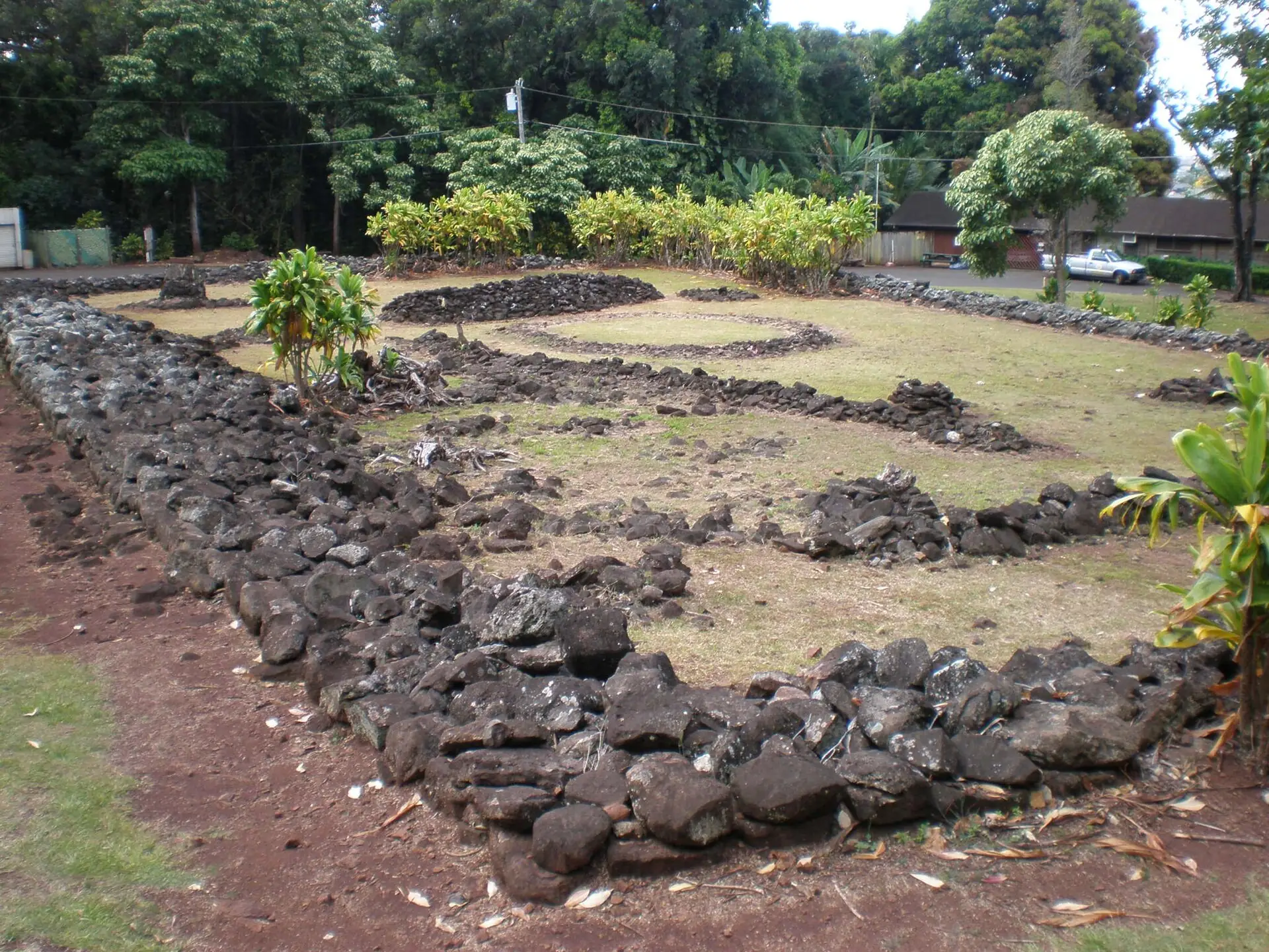
Keaīwa Heiau: The Healing Temple at the Gate
Keaīwa Heiau is a heiau hoʻola, a healing temple. According to State Parks, a kahuna who specialized in healing diagnosed and treated illness here and trained haumana, students, in laʻau lapaʻau: healing with plants, fasting and prayer. Medicinal plants were gathered from the surrounding forest and planted around the heiau itself.
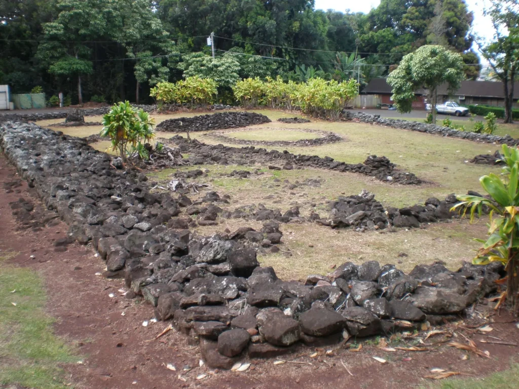
The stacked-stone enclosure measures about 100 by 160 feet and stands about 4 feet high. When it was built is unknown; one source credits Kakuhihewa, an aliʻi of Oʻahu, and his kahuna, Keaīwa, in the 16th century. Soldiers camped nearby during World War II took stones from it to build a road, and the heiau was rededicated in 1951, with medicinal plants replanted.
Visiting Respectfully
Look, Don’t Touch
State Parks asks visitors not to move, remove or wrap the rocks, and not to leave coins, incense, candles or other offerings. They are not traditional, and they damage the site over time.
The ʻAiea Ridge Trail: For Experienced Hikers Only
Near Puʻu ʻUau, the ʻAiea Ridge Trail branches off the loop and climbs toward the Koʻolau summit. It is a different hike: much longer, steep and muddy, with narrow ridge sections and drop-offs. Do the loop unless you are an experienced ridge hiker with a full day and good boots.
Safety and What to Bring
- Mud and roots. The trail stays slick after rain. Wear shoes with grip, not sandals.
- Rain. State Parks says to be ready for light passing showers. Bring a light layer.
- Water. Carry your own; there is none on the trail.
- Stay on the trail. Avoid side trails and shortcuts.
- Watch the gate. The park closes at 6:45 p.m. from the day after Labor Day through March. With up to 3 hours on the loop, start by early afternoon.
- Camping. The park’s campground is temporarily closed; check State Parks before planning an overnight.
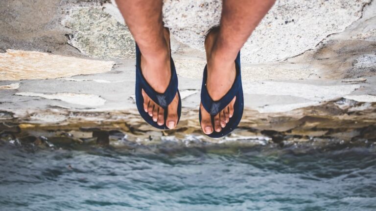
If you want something shorter and flatter, our easy Oahu hikes you can do in flip-flops are the other end of the scale.
Pairing It with Pearl Harbor
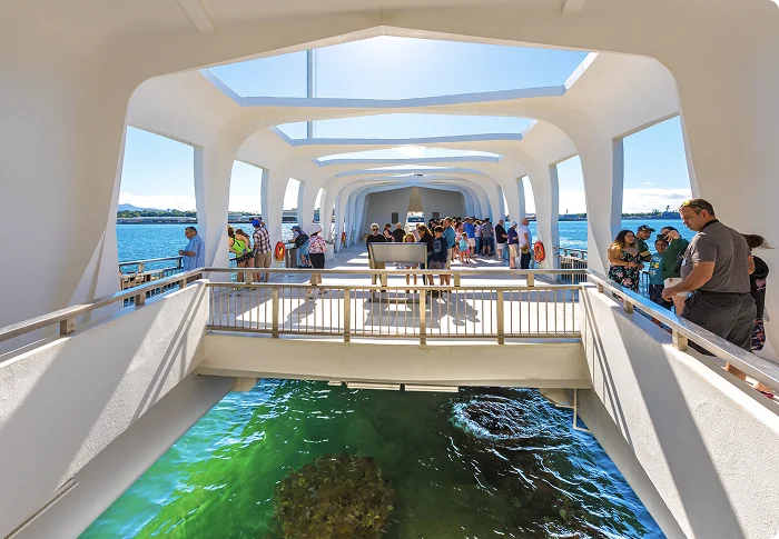
ʻAiea and the Pearl Harbor Visitor Center sit on the same side of Honolulu, so the two fit in one day. Book the USS Arizona Memorial first, since it is the part with limited slots: our Pearl Harbor tickets guide covers the Recreation.gov release. Then hike the loop before or after your program time.
One catch: Pearl Harbor does not allow bags that offer concealment past security, so leave the muddy daypack in the car. Parking at the visitor center is $7 a day. If you would rather not drive to Pearl Harbor at all, see our guides to getting to Pearl Harbor from Waikiki and Pearl Harbor tours.

Salute to Pearl Harbor Tour: USS Arizona Memorial from Waikiki
★★★★★ 4.7 · 8,965 reviews · From $59
Check AvailabilityWe may earn a commission if you book through this link, at no extra cost to you.
ʻAiea Loop Trail Questions
How long is the Aiea Loop Trail?
4.8 miles as a loop that starts and ends inside Keaīwa Heiau State Recreation Area. State Parks says to allow 2.5 to 3 hours.
Is there a fee to hike the Aiea Loop Trail?
No. Keaīwa Heiau State Recreation Area charges no entrance fee, and parking along the park road is free. There is no reservation system.
What are the park hours?
7 a.m. to 7:45 p.m. from April 1 through Labor Day, and 7 a.m. to 6:45 p.m. the rest of the year. The loop takes up to 3 hours, so start early enough to be back before the gate closes.
Is there a waterfall on the Aiea Loop Trail?
No. The only water on the loop is a stream crossing near the end, after a steep switchback.
Can you take TheBus to the Aiea Loop Trail?
Not to the trailhead. Route 551 climbs ʻAiea Heights Drive but its last stop, at Hoapono Place, is well below the park, and the rest is an uphill walk on the road. Plan on a car or a rideshare.
Can you still see the B-24 bomber wreckage?
Only in pieces. The 1944 crash site sits near Puʻu ʻUau, the high point of the loop, but a landslide pushed much of the wreckage down into the gulch, so it is hard to see from the trail.
Leave a Reply