
Beach · Waiʻanae Coast
Yokohama Bay: Surf, Safety and the End of the Road
Yokohama Bay is the common name for Keawaʻula, the last sandy stretch on Oʻahu’s west shore, where Farrington Highway ends at Kaʻena Point State Park. It is 51 minutes from Kapolei and 83 from Waikīkī by our routing, and the State has closed its gate for high surf before. As of November 15, 2026, DLNR lists the trail to Kaʻena Point from this side as closed. Here is what is open, when the water is safe, what is at the road end and how to treat the place.
Some links on this page are affiliate links. If you book or buy through them, we may earn a commission at no extra cost to you.
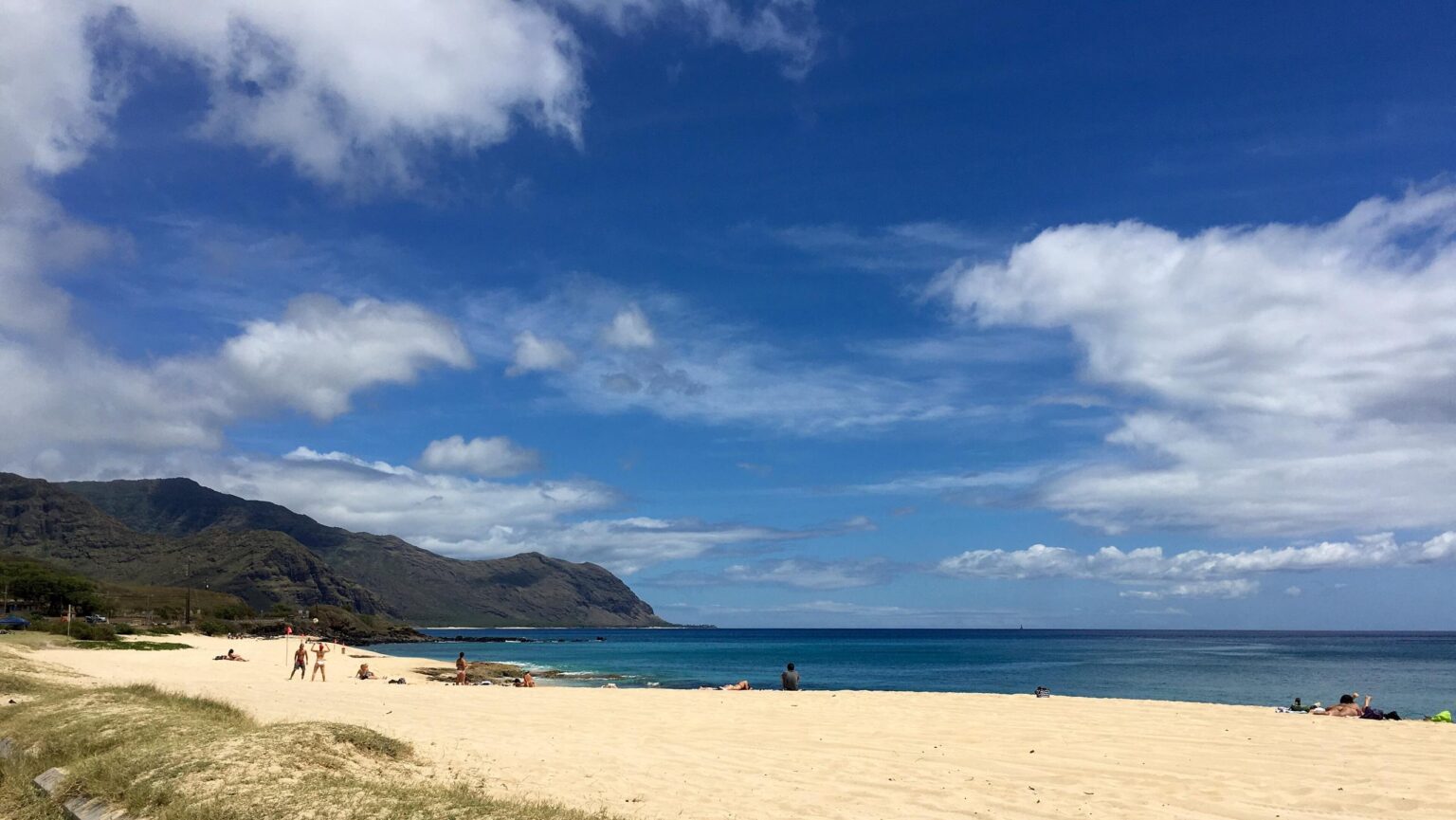
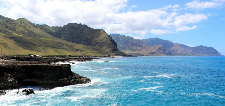
Keawaʻula Beach, known as Yokohama Bay, with the Waiʻanae Range at left. Photo: Thomas Woodtli, CC BY-SA 2.0, via Wikimedia Commons.
Quick Answer
Yokohama Bay is the Keawaʻula section of Kaʻena Point State Park, at the end of Farrington Highway, 23 miles and about 51 minutes from Kapolei by our routing. The park is open 6 a.m. to 7 p.m. and a lifeguard staffs Tower 50 from 8 a.m. to 6:30 p.m. DLNR says swimming is for calm summer conditions only. As of November 15, 2026 the Keawaʻula Trail is closed, vehicles are restricted past the restroom lot and DLNR lists Kaʻena Point State Park vehicle access as reopened in its November 12 notice. November to April is high-surf season on west shores, so ask the lifeguard before you swim.
- Address
- 81-601 Farrington Highway, Waiʻanae 96792 (Ocean Safety’s Tower 50 address)
- Hours
- Park open daily 6 a.m. to 7 p.m. (DLNR)
- Lifeguards
- Tower 50, 8 a.m. to 6:30 p.m. daily
- Parking
- The comfort station lot; DLNR restricts vehicles past the restroom lot, and its Nov 12 notice lists Kaʻena Point State Park vehicle access as reopened
- Restrooms
- Comfort station reopened (Nov 12 notice); no drinking water
- Trail to Kaʻena Point
- Keawaʻula Trail CLOSED (DLNR notices, Sep 14 and Nov 12)
- Not allowed
- Dogs, drones, camping, alcohol, smoking, driving on the beach
- Drive from Kapolei
- 23 miles, about 51 minutes without traffic, by our routing
- Managed by
- Hawaiʻi DLNR Division of State Parks
Facts from DLNR State Parks, Honolulu Ocean Safety and our own OSRM routing, checked Nov 8, 2026.
What Is Open: Status on November 15, 2026
DLNR’s Important Park Notices page, in its November 12 entry for the Hurricane Nolo and Hurricane Lowell recovery, says the Keawaʻula Trail “remains CLOSED and vehicle access is restricted past the restroom parking lot due to storm inflicted road damage,” and that the comfort station has reopened (DLNR notices). The same entry says Kaʻena Point State Park vehicle access has reopened. The park page says the section was “partially reopened to the comfort station parking lot” on September 14 (DLNR park page).
Neither notice calls the beach open or closed. They describe the lot, the road beyond it and the trail. We read both pages on November 15, 2026, and DLNR changes them without warning, so open the park page the morning you go. A high-surf closure can also shut the gate on the day (see the water section).
| What | DLNR says | Notice |
|---|---|---|
| Keawaʻula Trail to Kaʻena Point | Closed | Sep 14 and Nov 12 |
| Road past the restroom parking lot | Vehicle access restricted, storm damage | Nov 12 |
| Vehicle access | Reopened | Nov 12 |
| Comfort station | Reopened | Nov 12 |
| Park hours | Daily 6:00 a.m. to 7:00 p.m. | Park page |
Surf, Lifeguards and When the Water Is Safe
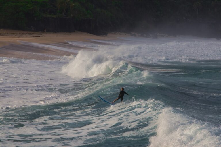
DLNR describes “a large sandy beach” here “with board surfing and body surfing for experts and swimming only during calm conditions in the summer” (DLNR). The State Parks record lists dangerous shorebreak, strong current and falling rocks as the hazards (State Parks record). The state tourism site calls Keawaʻula “the last sandy stretch on the west shore” and a spot to watch surfers and dolphins (Hawaiʻi Tourism Authority).
Lifeguards. Honolulu Ocean Safety lists Tower 50 at 81-601 Farrington Highway, open 8 a.m. to 6:30 p.m. every day (Ocean Safety). No tower is staffed outside those hours, and the park stays open until 7 p.m.
Winter. Hawaii Ocean Safety puts the winter season at November through April and says to expect “extremely high surf at many north and west shore beaches.” It adds that north swells can wrap around to the west shores at any time of year (Hawaii Ocean Safety). Our Oahu in November guide covers what the first big-surf month looks like island-wide, and is it safe to swim on Oʻahu today explains how to read a day.
The gate closes for surf. On January 21, 2014 DLNR closed the gate at this section with waves of 20 to 30 feet forecast and had lifeguards clear the park by sundown. State Parks administrator Dan Quinn said the waves “could wash over the low-lying sections of Kaʻena Point State Park road, trapping people on the other side” (DLNR, 2014). On January 20, 2015 DLNR closed it again until high surf subsided and lifeguards issued an all-clear (DLNR, 2015).
Signs. Honolulu Ocean Safety says shorebreaks are “unpredictable and dangerous,” that “small and high surf can be equally dangerous and can cause serious injury or death,” and that strong currents often come with high surf. It says to ask a lifeguard about conditions before you enter the water, and that a No Swimming sign means “do not enter water” (Ocean Safety, beach signs).
After rain. The Hawaiʻi Department of Health posted brown water advisories that name Yokohama on March 12, September 16 and October 1, 2026, and all three showed as closed in its feed on October 25 (DOH Clean Water Branch). Its advice is to stay out of water that looks brown or murky for 48 to 72 hours after the rain stops.
- Ask the lifeguard first: Tower 50 is staffed 8 a.m. to 6:30 p.m.; ask about today, not the season.
- Summer calm only: DLNR’s wording is swimming “only during calm conditions in the summer.”
- Skip it in winter swell: the State expects extremely high surf on west shores from November to April.
- Brown water, stay out: DOH’s rule after storms and heavy rain.
- Know the exit: on a high-surf day the road can flood, and DLNR has closed the gate for it.
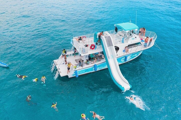
Oahu Dolphin and Snorkel Tour with Waikiki Pickup and Lunch
★★★★★ 4.5 · 1,795 reviews · From $165
Check AvailabilityWe may earn a commission if you book through this link, at no extra cost to you.
Restrooms, Showers and What Is Not Here
The State Parks record for the park lists a restroom, showers and trash cans, and no drinking water (State Parks record). The park page says neither section has drinking water (DLNR). The comfort station reopened, and DLNR’s November 12 notice still lists it as open, after a period with portable toilets only (DLNR notices). Bring your own water.
DLNR asks visitors to pack out what they pack in and puts marine debris drop-off stations beside the shoreline. Shoreline fishing is one of the park’s listed uses, and the park has collection bins for used fishing line and hooks (DLNR trail page).
Getting There: Farrington Highway to the Road End
Keawaʻula Beach, the end of the pavement and the trail toward Kaʻena Point. The trail is placed approximately; check DLNR’s notices before you go. Map data © OpenStreetMap contributors.
DLNR’s directions from Honolulu are to take H-1 west, which becomes Farrington Highway (Route 93). The highway becomes two lanes at its northern end and “terminates at Kaʻena Point State Park” (DLNR trail page). The pavement ends where a rough four-wheel-drive road begins, and DLNR now restricts vehicles past the restroom lot.
The times below are our own OSRM routing to the end of the pavement, with no traffic (OSRM, run October 25, 2026). Add time for traffic and the two-lane stretch.
| From | Miles | Minutes, no traffic |
|---|---|---|
| Mākaha Beach Park | 6.5 | 14 |
| Ko Olina lagoons | 19.3 | 45 |
| Kapolei | 23.2 | 51 |
| Central Waikīkī | 45.8 | 83 |
Staying at Ko Olina or in Kapolei? Both are the short way in. From Waikīkī, treat it as a half-day trip, and see our guide to whether you need a car on Oʻahu. For other beaches, see the best beaches on Oʻahu and our things to do on Oʻahu guide.
Lock the car and keep bags out of sight. The Honolulu Police Department says to lock car doors and not leave packages or bags in plain view (HPD visitor information). We found no published break-in count for this lot, so we are not calling it a hot spot.
Rental car
Driving to the end of Farrington Highway
Yokohama Bay is 46 miles and about 83 minutes from Waikīkī by our routing, and the road ends at the park. Compare Oahu rental cars on DiscoverCars.
We may earn a commission if you book through this link, at no extra cost to you.
The Name: Keawaʻula and Yokohama
The Hawaiian name is Keawaʻula. Peter T. Young’s Images of Old Hawaiʻi gives it as “red harbor or land” and says it came from the squid that used to come into the area (Young). Hawaii News Now says it is named for the cuttlefish in the bay (Hawaii News Now, 2014).
The accounts of “Yokohama” differ. Hawaii News Now calls Keawaʻula “a famous fishing spot for many immigrants, many of whom were from Yokohama, Japan.” Young records others: a favorite fishing spot for Japanese living on Oʻahu who gave it the nickname, a Japanese man who ran the train station there, and the landing place of the first Japanese laborers when the Oʻahu Railway was extended around Kaʻena Point. None of them dates the name, and we are not picking one. DLNR describes the trail as an old railroad bed and former dirt road (DLNR).
Sunset and Closing Time
Keawaʻula is on the west side of the island (DLNR). The U.S. Naval Observatory’s data for this coast gives the times below (USNO, computed for the Keawaʻula road end). In the short days of winter the sun is down well before the lifeguards leave, and in late June it sets after the park’s 7 p.m. closing.
| Date | Sunset | Lifeguards leave 6:30 | Park closes 7:00 |
|---|---|---|---|
| Nov 17, 2026 | 5:50 p.m. | 40 minutes after | 70 minutes after |
| Dec 21, 2026 | 5:56 p.m. | 34 minutes after | 64 minutes after |
| Jan 15, 2027 | 6:12 p.m. | 18 minutes after | 48 minutes after |
| Mar 20, 2027 | 6:44 p.m. | 14 minutes before | 16 minutes after |
| Jun 21, 2027 | 7:18 p.m. | 48 minutes before | 18 minutes before |
Plan the drive back before dark: Farrington Highway narrows to two lanes at its northern end (DLNR). For a sunset closer to town, see our Waikīkī sunset guide.
The Trail to Kaʻena Point From This Side
DLNR measures the walk from the Keawaʻula road end to the Kaʻena Point reserve at about 2.5 miles one way, along boulder beaches, with a pair of small blowholes midway and places where the old road has eroded completely (DLNR trail page). As of November 15, 2026 it is closed. Our Kaʻena Point State Park guide covers the Mokulēʻia-side walk, which the notices do not close, plus the rules and the albatross.
Rules, Wildlife and Respect
Vehicles. DLNR’s park rules say to drive and park “only on designated roads and parking areas” (State Parks rules), and the State Parks record lists motorized vehicles and driving on the beach as prohibited (State Parks record). Stay on the pavement and in the lot. On the other side of the point, DLNR says its vehicle permit system, started in 2015, aims to curtail 20 years of landscape damage from uncontrolled four-wheel-drive use (DLNR).
Not allowed. Dogs, drones, camping and commercial activity are not permitted (DLNR), and the State Parks record adds alcohol and smoking. Report violations to 643-DLNR (643-3567); call 911 for emergencies (DLNR).
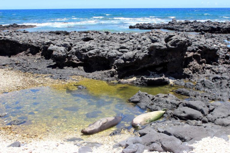
Monk seals and dolphins. NOAA says to stay at least 50 feet from Hawaiian monk seals on land and in the water, and at least 150 feet from a mother and her pup. Federal law bars swimming with, approaching or staying within 50 yards of spinner dolphins (NOAA Fisheries). Sea turtles get at least 10 feet.
Albatross. Laysan albatross nest in the reserve at the point, which the closed trail leads to. DLNR asks visitors to stay on marked trails and watch wildlife “respectfully, from a distance” (DLNR, 2019).
- Stay on the road: no driving on the sand, and none past the restroom lot while DLNR restricts it.
- Give seals 50 feet: 150 feet for a mother and pup.
- Pack out trash and fishing line: use the bins DLNR provides.
- Leave the dog home: dogs are not allowed in the park.
Yokohama Bay Questions
Is Yokohama Bay open?
DLNR’s November 12, 2026 notice lists the Keawaʻula Trail as closed, vehicle access as restricted past the restroom parking lot, Kaʻena Point State Park vehicle access as reopened and the comfort station as reopened. It does not call the beach open or closed. Check the DLNR park page the morning you go.
Is Yokohama Bay the same as Keawaʻula?
Yes. Keawaʻula is the Hawaiian name for the beach and the park section. Yokohama Bay and Yokohama Beach are the common names.
Can you swim at Yokohama Bay?
DLNR says swimming only during calm conditions in the summer. Winter brings extremely high surf to many west shore beaches, and DLNR has closed the gate for high surf. Ask the lifeguard at Tower 50 first.
Are there lifeguards at Yokohama Bay?
Yes. Honolulu Ocean Safety staffs Tower 50 from 8 a.m. to 6:30 p.m. daily. The park stays open until 7 p.m.
How far is Yokohama Bay from Waikīkī?
About 46 miles and 83 minutes without traffic by our routing. From Kapolei it is 23 miles and 51 minutes.
Why is it called Yokohama Bay?
Accounts differ. Hawaii News Now says Keawaʻula was a fishing spot for immigrants, many from Yokohama, Japan. Other accounts name Japanese railway laborers and a station worker. None dates the name.
Is the Kaʻena Point trail from Yokohama Bay open?
No. DLNR lists the Keawaʻula Trail as closed as of November 12, 2026. The Mokulēʻia-side walk is covered in our Kaʻena Point State Park guide.
Are there restrooms at Yokohama Bay?
DLNR’s November 12 notice lists the comfort station as reopened. There is no drinking water.
Can you camp or bring a dog?
No. DLNR does not permit camping or dogs in the park.
Sources, checked Nov 8, 2026
- Kaʻena Point State Park (DLNR State Parks)
- Kaʻena Point Trail (DLNR State Parks)
- Important Park Notices, Nov 12, 2026 (DLNR State Parks)
- Park Rules (DLNR State Parks)
- Park hazards and prohibited items (State Parks data)
- Keawaula beach closed for high wave danger (DLNR, Jan 21, 2014)
- Keawaula beach closed due to high surf (DLNR, Jan 20, 2015)
- Seabird and fence update (DLNR, Feb 5, 2019)
- Lifeguard tower locations (Honolulu Ocean Safety)
- Understanding beach signs (Honolulu Ocean Safety)
- Hawaii’s surf seasons (Hawaii Ocean Safety)
- Viewing marine wildlife (NOAA Fisheries)
- Keawaʻula Beach (Hawaiʻi Tourism Authority)
- Visitor information (Honolulu Police Department)
- Water quality advisories (Hawaiʻi Department of Health)
- Hawaiian Word of the Day: Keawaula (Hawaii News Now, Jun 6, 2014)
- Keawaʻula (Images of Old Hawaiʻi, Peter T. Young)
- Sun and moon data (U.S. Naval Observatory)
- Drive times, our calculation (OSRM, Oct 25, 2026)
Researched from the sources above, checked Nov 8, 2026. We never claim a visit we did not make; first-hand notes are marked as Stew’s. How we research and review.
Leave a Reply