
Hike · Kaʻiwa Ridge, Lanikai
Lanikai Pillbox Hike: Parking, Hours and Safety
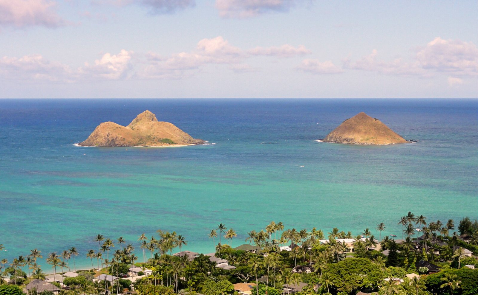
The Lanikai Pillbox hike climbs Kaʻiwa Ridge behind Lanikai to two concrete World War II bunkers looking straight out at the Mokulua islands. The State lists it at 0.84 mile each way with a 600 ft elevation change, calls it undeveloped, very steep and slippery, and warns that parking is very limited. Here is where to leave the car, what the climb is like and what the bunkers really were.
Some links on this page are affiliate links. If you book or buy through them, we may earn a commission at no extra cost to you.
Quick Answer
The trail starts off Kaʻelepulu Drive in Lanikai, and there is no parking there. Park at Kailua Beach Park and walk about 0.6 mile by our routing, or ride TheBus Route 671. The State lists 0.84 mile each way and a 600 ft elevation change, open sunup to sundown, with no fee or permit listed. It is short but steep, dusty when dry and slick when wet, with no shade, water or restroom.
Lanikai Pillbox at a Glance
The State’s trail record describes it in four lines: the trail “climbs up the ridge behind Lanikai,” runs through native and introduced coastal plants, “ends at the first WWII bunker,” and “is currently an undeveloped trail and receives minimal maintenance from the State of Hawaii” (Nā Ala Hele). The record lists no difficulty rating. Its hazard list does the talking instead: dangerous cliff, narrow trail, sudden drop-off, uneven surface, dangerous footing and sun exposure.
Our Oahu hikes map rates it Hard for that reason: a 600 ft climb is moderate on paper, but this one gets almost no upkeep. The State publishes no hiking time, so the 50 minutes in the table is ours: Naismith’s rule (3 miles an hour, plus 30 minutes for every 1,000 feet of climb) applied to the State’s 1.68 miles there and back and its 600 feet.
| Detail | Kaʻiwa Ridge Trail (Lanikai Pillbox) |
|---|---|
| Trailhead | Kaʻelepulu Drive off ʻAʻalapapa Drive, Kailua 96734, near Mid-Pacific Country Club |
| Distance | 0.84 mile one way, per the State, to the first bunker. The City calls it a half-mile hike |
| Elevation change | 600 ft, per the State |
| Hours | Sunup to sundown, per the State |
| Fee or permit | None listed by the State |
| Walking time | About 50 minutes up and back by our arithmetic, before stops |
| Managed by | Nā Ala Hele Trail and Access Program, DLNR Division of Forestry and Wildlife |
| Parking | None at the trailhead. Nearest public lot: Kailua Beach Park, about 0.6 mile away |
| Not allowed | Commercial tours, alcohol, camping, bicycles, horses, hunting, littering, dogs off leash |
Where to Park (and Where Not To)
This is the part most visitors get wrong. The State’s directions run through Kailua town, past Kailua Beach Park, onto ʻAʻalapapa Drive and right onto Kaʻelepulu Drive, then stop with a line in capitals: “Do not drive or park beyond this point.” The same record warns that “parking is very limited” and “cars parked illegally will be towed” (Nā Ala Hele).
The City is blunter. Its 2025 Lanikai traffic plan says the hike “is accessed via private property off of Kaʻelepulu Drive” and that “there is no parking available as well as no restrooms or other supportive infrastructure near the embarkation point.” It put up “NO PARKING” signs along Kaʻelepulu Drive, and still reports that “illegal parking persists.” Residents and Mid-Pacific Country Club have noted trespassing, “unauthorized use of facilities” and blocked roads (City DTS). So do not park in Lanikai, on its unpaved shoulders or at the club, and do not use the club’s restrooms.
Park at Kailua Beach Park instead. The City says Lanikai has no public lots, which makes the beach park the nearest legal one. By our routing it is about 0.6 mile, roughly 13 minutes on foot, from the boat ramp lot to the trailhead (OSM). The park’s lots close from 10 p.m. to 5 a.m. (City parks), so they are open well before the trail is. From central Waikīkī the drive is about 16 miles and 34 minutes without traffic by our routing (OSRM). Our Kailua Beach Park guide covers the park.
Holidays are stricter. Over Christmas weekend 2025 and New Year’s weekend 2026, the City banned parking from 10 a.m. to 3 p.m. on “all streets and shoulders of Mokulua and ʻAʻalapapa Drives” and their cross streets (DTS, DTS). Check DTS before a holiday weekend.
By bus: TheBus Route 671, Kailua to Lanikai, stops at ʻAʻalapapa Drive and Kaʻelepulu Drive, about 0.17 mile from the trailhead by our routing. On a weekday such as Wednesday, October 28, it passes that stop 21 times between 6:21 a.m. and 6:51 p.m., 31 to 43 minutes apart (TheBus schedule data, through Dec 5). The City’s plan notes that Routes 66 and 67 connect Kailua with Ala Moana Center, where transfers to the rest of the island are available. Our guide to getting around Oahu covers TheBus.
The Climb, Trailhead to Bunkers
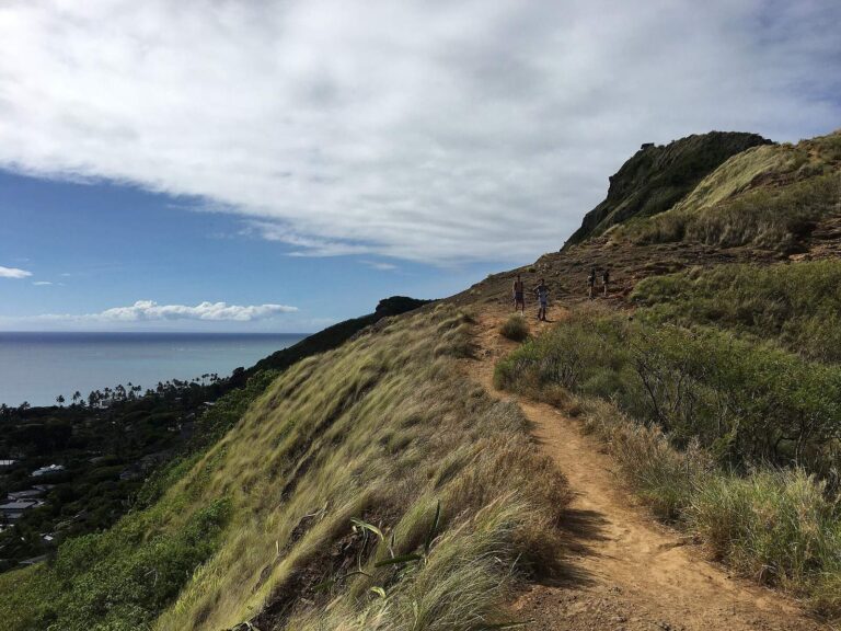
The City describes the route in one sentence: “the trail begins with a short, steep ascent and follows a meandering path to World War II-era military observation bunkers” (City DTS). DLNR’s version: “an initial steep hike, then a rocky trail, which is narrow at times” (DLNR, 2018).
The State’s record calls the ground “dry, hot, dusty when dry, slippery when wet” and the trail “very steep and slippery,” with a reminder to watch your step “while on the bunkers” too (Nā Ala Hele). It lists no water, shade, restroom or trash can. Bring water, a hat and shoes with real tread; the State’s own trail tip is covered shoes.
Stay on the main path. The record warns that side trails and roads off the public route “may be on private property,” and that using them without the landowner’s approval means “you will be trespassing and possibly putting yourself at risk.” The State’s trail ends at the first bunker. A second, two-tier bunker sits a little farther along the ridge, and DLNR noted in 2018 that fewer hikers go on to it.
- Shoes: closed-toe with grip. The State calls the trail very steep, dusty when dry and slippery when wet.
- Time it: go early. The State calls this a very high use trail, and the ridge has no shade.
The Pillboxes Are Not Pillboxes
DLNR says so itself: “The Lanikai pillboxes are not really pillboxes. The two famed ‘pillboxes’ on the trail are misnamed. In military terms, a pillbox means a defensive site such as a machine gun pillbox. The two concrete structures on Kaʻiwa Ridge were built to be observation stations, not sites for defensive armaments” (DLNR, 2018).
They were coast artillery stations, part of Station Podmore. According to military historian John D. Bennett, quoted by DLNR, they were built in 1943 and “equipped with high-powered telescopes to fix positions of possible enemy ships.” Soldiers inside passed target information to artillery batteries on the Mōkapu Peninsula, and later to batteries at the Kāneʻohe Bay Naval Air Station and Puʻu Papaʻa. The first structure is Station 29A, a single tier; the second, two-tier one holds Stations 29B and 29C.
The roofs you stand on were rebuilt in 2018. The State closed the trail for 60 days that summer for “concrete spall repair, and removal and replacement of rusted steel roof supports,” a $248,228 job, and reopened it on August 20, 2018 (DLNR).
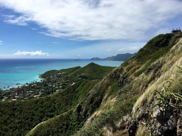
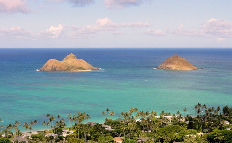
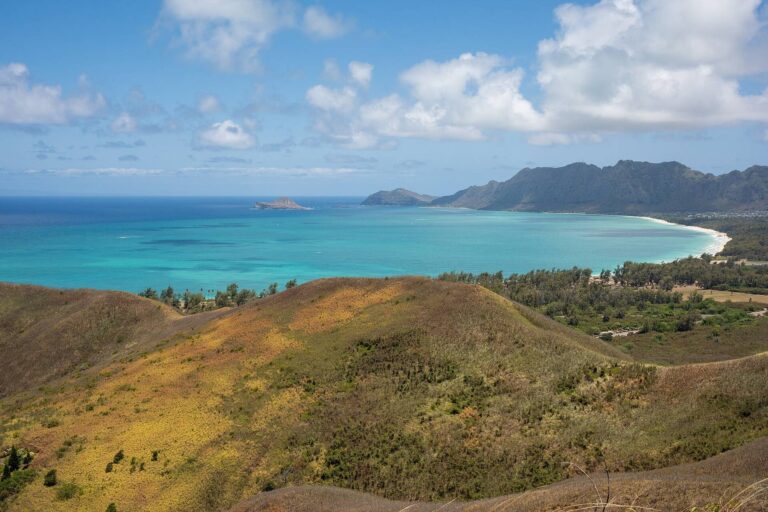
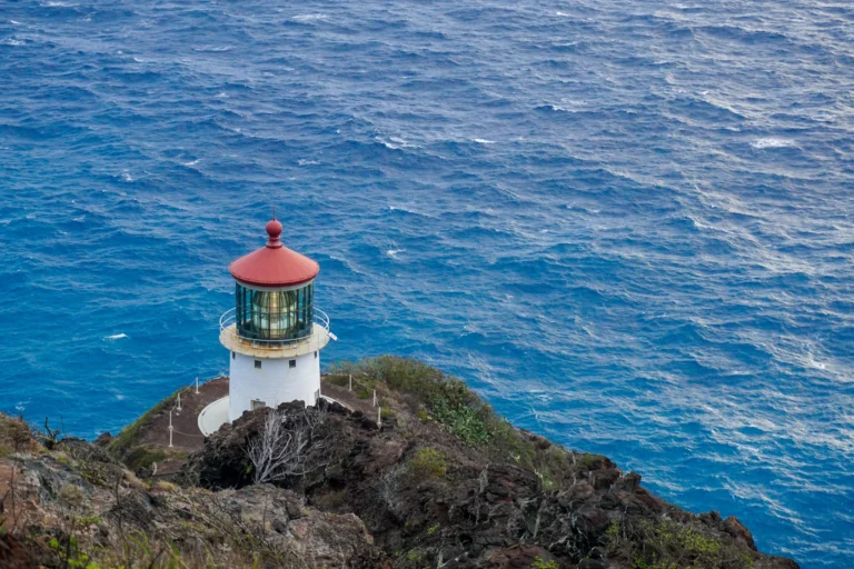
The view is the reason for the climb. DLNR’s description: “stunningly beautiful views of the Mokulua Islands and the entire windward coast of Oahu, from Waimanalo to Mokoliʻi island” (DLNR). Look south and the ridge drops toward Waimānalo Bay and the cliffs running out to Makapuʻu, where the Makapuʻu Lighthouse trail climbs the far point.
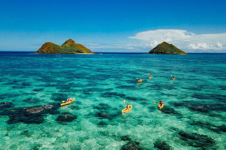
Kayak to the Mokulua Islands from Kailua Beach
★★★★★ 5 · 429 reviews · From $275
Check AvailabilityWe may earn a commission if you book through this link, at no extra cost to you.
Rescues, Heat and Hours
The Honolulu Fire Department has posted five rescue releases for this trail so far in 2026, six in 2025 and five in 2024 (HFD). Nearly every one describes a single hiker who was hurt and could not get down alone. On October 16, 2026, a woman in her 50s “sustained an injury and could not continue on her own”; six units and 18 firefighters responded, and the Air 1 helicopter flew her to a landing zone (HFD). On September 1, crews carried a visitor in her 20s with an ankle injury down the trail in a litter basket (HFD).
Hours. The State says “the trail is only open from Sunup to Sundown” (Nā Ala Hele). On October 28, 2026, that is about 6:32 a.m. to 5:57 p.m. in Lanikai by our calculation from NOAA’s solar equations; in late December, about 7:04 a.m. to 5:54 p.m. There is no legal pre-dawn start for sunrise on the bunkers.
Closures. From May 2025 to February 2026 the State closed the trail on a handful of scheduled mornings while crews treated the ridge for little fire ants by drone, with Nā Ala Hele stewards posted at the trailhead (DLNR, 2025). As of October 23, 2026, the State’s record shows the trail open with no announcements. Check it the morning you go.
- Know your limit. HFD’s checklist: water, snacks, a charged phone, a flashlight and a whistle, and hike with a partner (HFD outdoor safety).
Rules on the Ridge, and Why There Are No Tours
The State’s record prohibits alcohol, camping, bicycles, horses, hunting, fishing, ATVs, littering and commercial activity on the trail. Dogs are allowed on a leash; the State asks owners to pick up after them and to “bring extra water for their dogs on this trail,” since there is none (Nā Ala Hele).
The commercial ban is why we do not link a guided Lanikai Pillbox hike, though tour sites sell them. The State’s record lists commercial use as prohibited. If you want a guide in Lanikai, book one on the water instead (below).
There is no reservation or fee today. The City’s 2025 plan floated managed access, such as daily caps for non-residents, but only as a concept (City DTS).
How the Lanikai Pillbox Compares
Lanikai is the short hike with the Mokulua view, and the hardest of the short hikes to park for. The others near town trade it for crowds, reservations or stairs. For every trail on the island, see the Oahu hikes map; for the drive that ties Lanikai to the east side, see the east side Oahu drive.
| Hike | Distance | Climb | The catch |
|---|---|---|---|
| Lanikai Pillbox (Kaʻiwa Ridge) | 0.84 mi one way | 600 ft change | No trailhead parking; steep, minimal maintenance |
| Diamond Head | 1.6 mi round trip | 560 ft | Non-residents need a timed reservation |
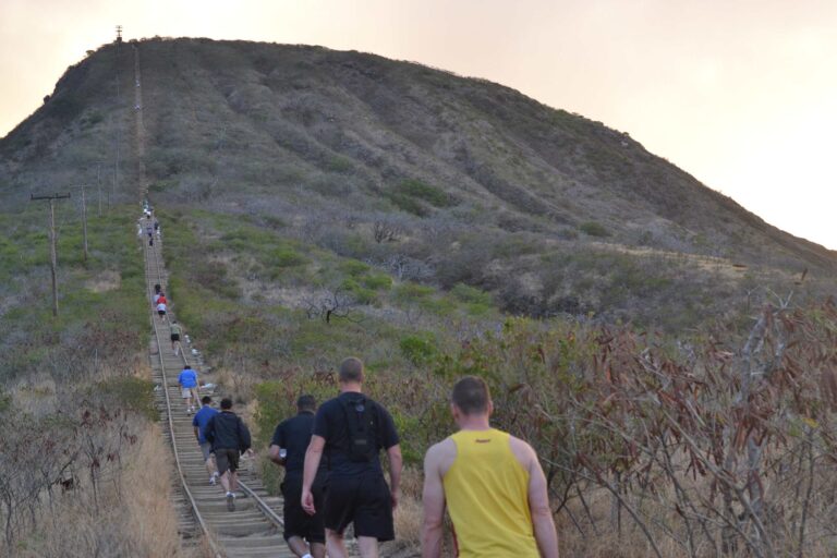
| Koko Head stairs | 1,048 steps; the City lists no distance | none published | Little shade; frequent rescues |
| Makapuʻu Lighthouse | 2 mi round trip | 500 ft | Upper viewing area closed weekends and holidays to Nov 4, 2026 |
| Mānoa Falls | 0.8 mi one way | 396 ft change | Paid private parking; mud |
- Pick Lanikai for the Mokulua view, and only if you can walk in from the beach park or bus.
- Pick Diamond Head for the classic crater view, and book the slot first.
- Pick Makapuʻu for a wide path with a lighthouse at the end.
- Pick Koko Head for a straight-up workout in full sun.
Rental car
The easiest way to the windward side
Lanikai has no trailhead parking, but Kailua Beach Park has a public lot that opens at 5 a.m., and the same car covers Makapuʻu and the east side drive. Compare Oahu rental cars on DiscoverCars.
We may earn a commission if you book through this link, at no extra cost to you.
Lanikai Pillbox Hike: Questions
How long is the Lanikai Pillbox hike?
The State lists 0.84 mile one way with a 600 ft elevation change, so about 1.7 miles there and back. The City calls it a half-mile hike. By our arithmetic it is about 50 minutes of walking up and back, before stops.
Where do you park for the Lanikai Pillbox hike?
Not in Lanikai. The State says not to drive or park past Kaʻelepulu Drive, and the City says there is no parking at the trailhead. Park at Kailua Beach Park, about 0.6 mile away by our routing, or take TheBus Route 671.
Can you hike the Lanikai Pillbox for sunrise?
The State opens the trail from sunup to sundown, so you cannot start in the dark to be on top at sunrise. Go at first light instead.
Is the Lanikai Pillbox hike hard?
It is short but steep. The State calls the trail undeveloped, very steep and slippery, with minimal maintenance, cliffs and drop-offs, and HFD rescues injured hikers there several times a year.
Are there guided Lanikai Pillbox tours?
Tour sites sell them, but the State’s trail record lists commercial activity as prohibited, so we do not recommend one. Guided kayak trips to the Mokulua islands leave from Kailua Beach Park.
What are the Lanikai pillboxes?
Not pillboxes. DLNR says they are World War II observation stations, built in 1943 according to military historian John D. Bennett, used to spot ships and direct coast artillery.
Sources, checked Oct 23, 2026
- Kaiwa Ridge (Lanikai Pill Box), trail record 304 (Nā Ala Hele, DLNR)
- Lanikai pillbox repairs and military history (DLNR, Mar 16, 2018)
- Pillbox closure for repairs (DLNR, Jun 14, 2018)
- Trail reopens Aug 20 (DLNR, Aug 16, 2018)
- Little fire ant treatment closures (DLNR, May 6, 2025)
- Lanikai Transportation Management Plan (City DTS, June 2025)
- Lanikai parking restrictions, Christmas weekend (City DTS, Dec 2025)
- Lanikai parking restrictions, New Year’s weekend (City DTS, Dec 2025)
- Park closure hours (City Department of Parks and Recreation)
- Injured hiker rescued from the Lanikai Pillbox trail (HFD, Oct 16, 2026)
- Injured hiker rescued from the Lanikai Pillbox trail (HFD, Sep 1, 2026)
- Outdoor safety (Honolulu Fire Department)
- TheBus GTFS schedule data (feed Aug 9 to Dec 5, 2026)
- Drive distance, our calculation (OSRM, Oct 23, 2026)
- Trail route (OpenStreetMap, ODbL)
Researched from the sources above, checked Oct 23, 2026. We never claim a visit we did not make; first-hand notes are marked as Stew’s. How we research and review.
Leave a Reply