Hub · Oahu Hikes
Oahu Hiking Trails: The Best Hikes on Oahu, Mapped
Length, elevation gain and status on this map come from the agency that manages each trail: State Parks, the State’s Nā Ala Hele trail program, or the City’s parks department. Two trails have no published elevation, and Koko Head has no published length either; our figures for those are marked estimated. Tap a pin for the key facts and the official page, or read down by region. Closed trails and the famous ones no agency lists are covered below, so you know what to skip.
Some links on this page are affiliate links. If you book through them, we may earn a commission at no extra cost to you.
Tap a pin for the key facts, directions and the official page. On a phone, move the map with two fingers.
On this page
Oahu Hikes, Section by Section
- The mapEvery trailhead, with length, gain and the official page
- Waikiki and HonoluluDiamond Head Summit, Mānoa Falls, Waʻahila Ridge, ʻUalakaʻa, Judd
- East SideKoko Head Crater, Makapuʻu Point Lighthouse, Kuliʻouʻou Ridge, Wiliwilinui Ridge
- WindwardKaiwa Ridge (Lanikai Pillbox), Maunawili Falls, Hauʻula Loop, Kapaʻeleʻele, Nakoa
- North ShoreKealia, Kaunala
- Central and Pearl HarborʻAiea Loop, Mānana
- West SideKaʻena Point
- WaterfallsMānoa, Maunawili, Waimea Valley, Sacred Falls and Lulumahu
- Trails to skipThe famous trails no agency lists, and a closed one
- Before you goRain, hunting areas, daylight, car theft and leptospirosis
- QuestionsReservations, easy hikes, Maunawili and the waterfalls
How to read this page
Lengths, Gains and Our Label
Lengths and gains are printed as the managing agency prints them, with one way, round trip or loop noted wherever the agency’s own figure says which. Nā Ala Hele publishes a one-way length and an “Elevation Change”; State Parks trail pages give a “Trail Length” and an “Elevation Gain”, and each entry prints that length as its page states it. They are different measures, so compare entries with that in mind. The Easy, Moderate and Hard label is ours. Under 500 ft of gain is Easy, 500 to 1,000 ft is Moderate and over 1,000 ft is Hard. A trail moves up one tier where the State’s own record calls it difficult or says it is poorly maintained, and it is never rated below the State Parks rating. Koko Head and Maunawili Falls have no published elevation, so we give an estimate from open map elevation data and mark it “estimated”. The Koko Head length is our map figure too, because the City publishes none.
Hikes in Waikiki and Honolulu
Diamond Head, Mānoa Falls, Waʻahila Ridge, ʻUalakaʻa and Judd.
-
01
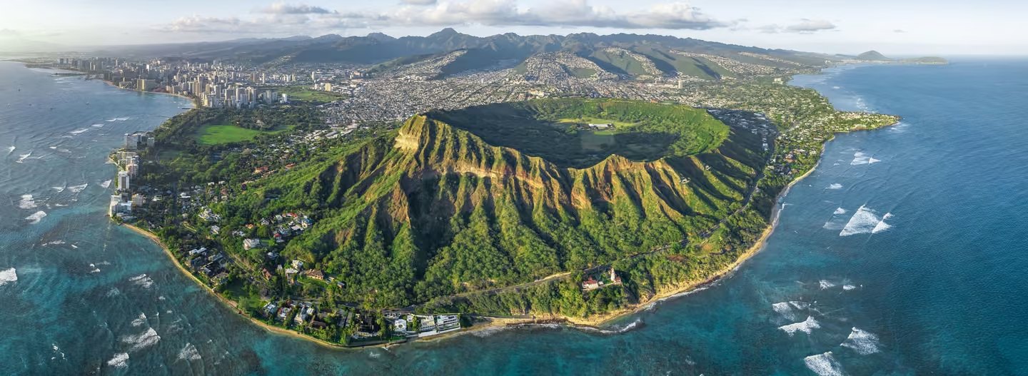
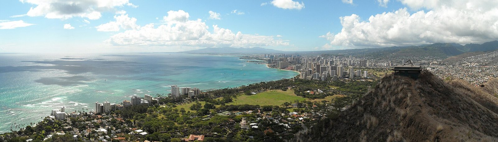
Diamond Head Summit Trail
Moderate · 0.8 mi one way · 560 ft gain
The hike climbs 560 feet from the crater floor, through a lighted 225-foot tunnel and up steep stairs, to a summit view of the shoreline from Koko Head to Waiʻanae. Non-residents need entry and parking reservations.
Dogs: No pets are allowed in the park except service animals. Fee: Non-residents pay $5 for entry and $10 per vehicle; Hawaiʻi residents are free with a Hawaiʻi ID; children 3 and under are free; credit card only. Parking: Adjacent to the trailhead inside the monument; the entrance is off Diamond Head Road between Makapuʻu Avenue and 18th Avenue. Hours: 6:00 am to 6:00 pm daily, last entry 4:30 pm for the 4:00 pm reservation; closed Christmas and New Year’s Day.
-
02
Mānoa Falls Trail
Easy · 0.8 mi one way · 396 ft gain
A short, well-maintained rain forest trail that ends at a graveled viewing area. The State asks hikers not to go past the rock wall viewing area, where it says rushing water, falling rocks and accidental falls have caused fatalities.
Dogs: Dogs must be leashed at all times, and owners remove dog waste. Fee: The State charges no fee to hike this trail. Parking: The Paradise Park lot is not State managed and charges a fee (the State record says $5); free parking is available in the lower neighborhood. Hours: Sunup to sundown, seven days a week; the State recommends not starting after 5:30 pm.
-
03
Waʻahila Ridge Trail
Moderate · 2.4 mi, as State Parks lists it · 500 ft gain
A ridge trail through partly native forest with views of Mānoa Valley, Pālolo Valley, Honolulu and the Koʻolau Range. It ends at the Kolowalu Trail junction, and the State asks hikers not to go on to the summit, a restricted watershed area.
Dogs: Keep dogs on leash; leashed dogs may cross the park to reach the trail. Fee: No entrance fee. Parking: Park in the provided lot and follow the trailhead signs. Hours: 7:00 am to 6:45 pm in winter, 7:00 am to 7:45 pm in summer (summer starts April 1, winter the day after Labor Day)
-
04
ʻUalakaʻa Trail
Easy · 0.53 mi loop · 400 ft gain
A short loop through thick forest canopy that ends at a four-way junction with the Makiki Valley, Moleka and Maunalaha trails. The State calls it a good family trail.
Dogs: Dogs must always be leashed, and owners remove dog waste. Fee: Parking is $7 per vehicle for non-residents; residents pay nothing. Parking: Drive up to the parking area, then walk back down the road to the trailhead. Hours: 7:00 am to 6:45 pm in winter, 7:00 am to 7:45 pm in summer (summer starts April 1, winter the day after Labor Day)
-
05
Judd Trail
Easy · 1.0 mi loop · 96 ft gain
A forested loop with a stream crossing, where the State warns the rocks are unstable and slippery. The State also calls the trailhead a high theft area, so leave nothing in the car.
Dogs: Dogs must be leashed at all times, and owners remove dog waste. Parking: Park along the road at the trailhead. The road is narrow with limited line-of-sight areas, and the State calls it a high theft area, so leave no valuables in the car.

Manoa Waterfall Hike with Waikiki Pickup & Healthy Lunch
★★★★★ 4.7 · 213 reviews · From $119
Check AvailabilityWe may earn a commission if you book through this link, at no extra cost to you.
East Side hikes
Koko Head, the Makapuʻu lighthouse trail and two ridge trails, Kuliʻouʻou and Wiliwilinui.
-
06
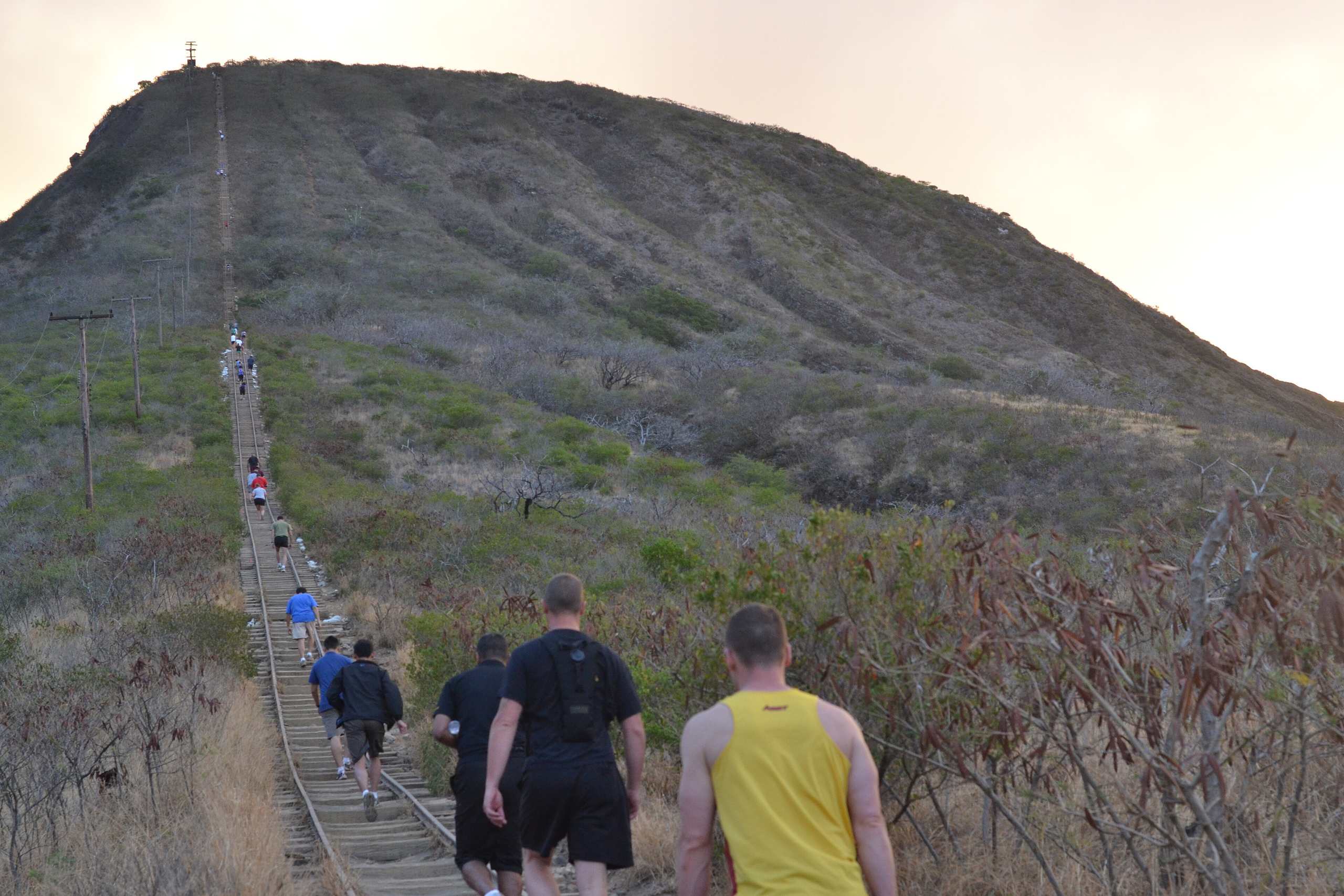
Koko Head Crater Trail
Hard · approximately 0.5 mi one way (estimated) · about 1,000 ft (estimated)
The City’s Koko Crater tramway has 1,048 wooden ties and leads to a summit with what the City calls exceptional 360-degree views of Oʻahu’s southeast corner. The City publishes no length or elevation, so both figures here are our estimates from open map data.
Hours: Park hours are 4:00 am to 11:00 pm every day; a vehicle gate closes from 11 pm to 4 am.
-
07
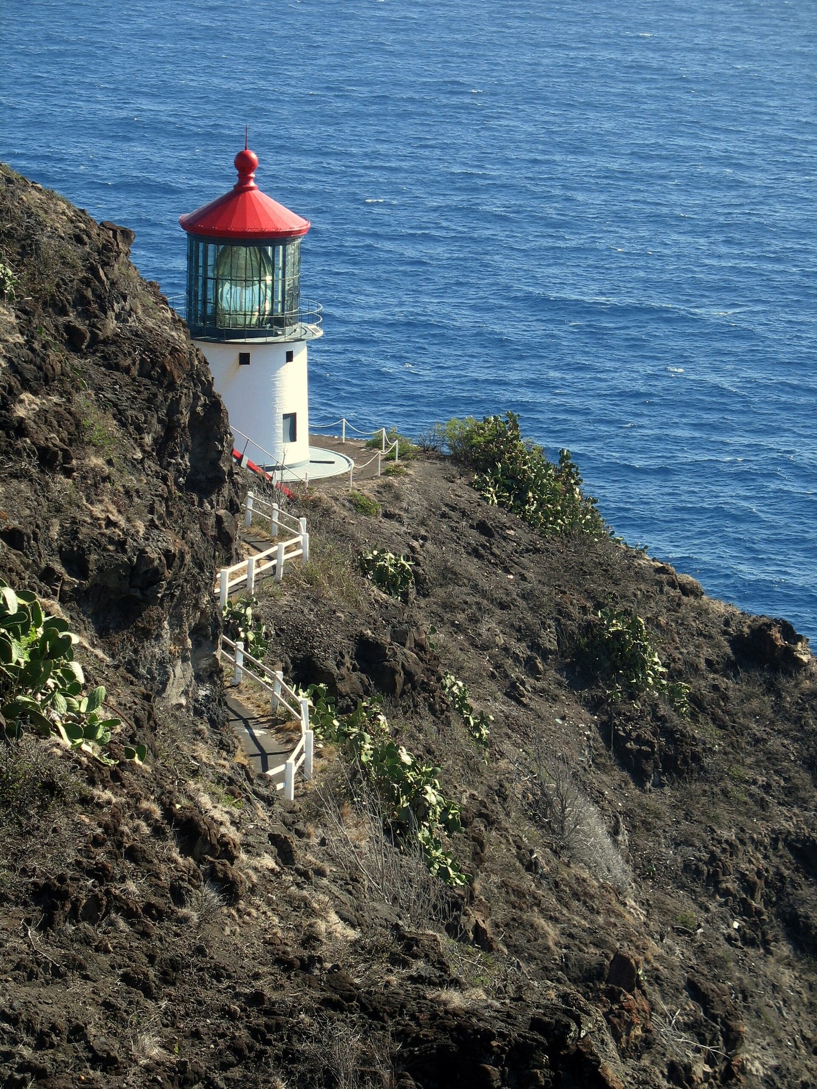
Makapuʻu Point Lighthouse Trail
Moderate · 2.0 mi round trip · 500 ft gain
A paved former lighthouse access road climbs to guard-railed lookouts, exposed, usually sunny and hot, and very windy at the summit. The lighthouse itself is off-limits but can be viewed from the trail.
Dogs: Dogs on leash. Fee: No entrance fee. Parking: A parking area gives access to the trailhead; no drinking water or restrooms are available. Hours: 7:00 am to 6:45 pm in winter, 7:00 am to 7:45 pm in summer (summer starts April 1, winter the day after Labor Day)
Status: The upper viewing area is closed for repairs from October 21 to November 4, 2026, with limited viewing available. It is closed all day on Saturdays, Sundays and holidays.
-
08
Kuliʻouʻou Ridge Trail
Hard · 2.1 mi one way · 1,605 ft gain
A ridge trail that becomes steeper as it follows the ridge, with an almost 360 degree view of the island. The State says the upper ridge is only occasionally maintained and may be difficult for inexperienced hikers.
Dogs: Dogs must be leashed at all times; hunting may be in progress. Parking: Street parking on Kalaʻau Place; do not park at the end of the cul-de-sac where it says no parking.
-
09
Wiliwilinui Ridge Trail
Hard · 2.3 mi one way by the State’s record; the trailhead is about 1.5 miles up the access road · 1,275 ft gain
An open ridgeline trail reached through a community access road, ending at a small knob with a superb view of the windward coast. The State asks hikers to check in with the security guard and follow the association’s rules.
Dogs: Dogs must be leashed at all times, and owners remove dog waste. Parking: Check in with the security guard, then park in the lot before the cable gate and walk the access road to the trailhead.
Windward hikes
Kaiwa Ridge, Maunawili Falls, the Hauʻula Loop and two Kahana trails.
-
10
Kaiwa Ridge (Lanikai Pillbox)
Hard · 0.84 mi one way · 600 ft gain
A steep climb up the ridge behind Lanikai that ends at the first WWII bunker. The State calls the trail undeveloped, very steep and slippery, and parking is very limited.
Dogs: Dogs must be leashed at all times; the State asks owners to bring extra water for them. Parking: Parking is very limited and illegally parked cars are towed; do not drive or park past Kaelepulu Drive. Hours: Sunup to sundown.
-
11
Maunawili Falls
Moderate · about 2 miles on the Maunawili Trail, then about 1 mile on the connector trail to the falls · about 500 ft (estimated)
The classic trailhead at the end of Maunawili Road is closed, so this entry follows the State land route from the Pali Highway overlook to the falls. The agency publishes no elevation figure for it. Hikers cannot exit through the private land and must go back the way they came.
Dogs: Dogs on leash. Parking: Drop-off only at the Pali Highway scenic overlook; long-term parking is not permitted.
Status: The trailhead at the end of Maunawili Road is closed. The State land portion is reached from the Pali Highway scenic overlook by the Maunawili Trail and the connector trail.
-
12
Hauʻula Loop Trail
Moderate · 2.5 mi loop, as the State lists it · 700 ft gain
A loop through mixed forest with views of Hauʻula and the ocean; hikers keep left and start clockwise. The trail crosses a public hunting area, and the State asks hikers to take care.
Dogs: Dogs must be leashed at all times; hunting dogs may be off leash. Parking: Park along the road before the cable gate without blocking it, and register at the nearby hunter and hiker check-in mailbox.
Status: A State partial closure for little fire ant eradication names hunting unit C and the Maʻakua Ridge-Papali Trail; the State’s notice says the trail is open outside the closure area.
-
13
Kapaʻeleʻele Trail
Easy · 1.2 mi round trip · 130 ft gain
A forest loop with views of Kahana Bay, Huilua Fishpond and two cultural sites related to fishing in the bay. The State warns of exposed tree roots, steep drop-offs and a very steep, slippery last section.
Dogs: Keep dogs on leash. Fee: No entrance fee; no permits are required. Parking: Park at the Orientation Center; the trail begins on the dirt road by the parking lot. Hours: 7:00 am to 6:45 pm in winter, 7:00 am to 7:45 pm in summer (summer starts April 1, winter the day after Labor Day)
-
14
Nakoa Trail
Moderate · 2.5 mi loop · 400 ft gain
A valley rainforest loop with stream crossings that the State says only sure-footed hikers should attempt. The State also warns that harmful bacteria such as leptospirosis may be present.
Dogs: Keep dogs on leash. Fee: No permits are required. Parking: Use the designated hiker parking area before the residences, and sign in at the hunter and hiker check-in station.
North Shore hikes
Kealia and Kaunala, ridge trails with views of the north shore; Kaunala is open only on weekends and State and National holidays.
-
15
Kealia Trail
Hard · 2.5 mi one way · 1,600 ft gain
Nineteen switchbacks climb above Dillingham Airfield to the cliff crest, where the trail becomes a dirt road up the ridge. The State warns that serious rock fall has occurred on this trail.
Dogs: Dogs must be leashed; hunting dogs may be off leash. Fee: The State’s record says a day use or camping permit from DLNR is required, printed in advance (online with a $2.50 service fee, or free by mail in up to 5 business days). Parking: The State’s directions give parking at Dillingham Airfield.
-
16
Kaunala Trail
Moderate · 2.5 mi one way · 600 ft gain
A ridge and valley trail with views of the North Shore and the Waianae range, open only on weekends and State and National holidays. Hikers sign in at the hunter and hiker check-in mailbox.
Dogs: Dogs must be leashed; hunting dogs may be off leash. Parking: Park below the Boy Scout camp along the road, then walk the dirt road; the trailhead is on the left about 3/4 mile down. Hours: Open only on weekends and State and National holidays.
Central Oahu and Pearl Harbor hikes
The ʻAiea Loop and the long Mānana ridge.
-
17
ʻAiea Loop Trail
Moderate · 4.8 mi loop · 900 ft gain
A forested ridge loop that starts in Keaīwa Heiau State Recreation Area and may pass remnants of a B-24 bomber that crashed in 1944. The State says it is not strenuous but includes gradual climbs, a steep switchback and a stream crossing at the end.
Dogs: Keep dogs on leash. Fee: No entrance fee. Parking: Park in a marked stall and look for the trail sign. Hours: 7:00 am to 6:45 pm in winter, 7:00 am to 7:45 pm in summer (summer starts April 1, winter the day after Labor Day)
-
18
Mānana Trail
Hard · 6.0 mi one way · 1,700 ft gain
A long ridge climb that goes up and down each puʻu to reach the Koʻolau summit in about 6 miles one way. The State says the latter half is not regularly maintained and may be difficult for inexperienced hikers.
Dogs: Dogs must be leashed; hunting dogs may be off leash. Parking: Park at the end of the road by the locked gate and walk through the pedestrian passageway beside it.
West Side hike
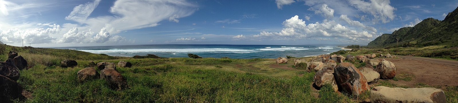
Kaʻena Point, reached here from the Mokulēʻia side.
-
19
Kaʻena Point Trail (Mokulēʻia end)
Moderate · about 2.5 mi one way · negligible gain
A hot, open walk along a volcanic coast with mountain and ocean views, about 2.5 miles one way from the Mokulēʻia end. The State notes little shade, no drinking water on either section, no restrooms on the Mokulēʻia section, and a wave-exposed coast to stay away from.
Dogs: No animals are allowed in the park or the Kaʻena Point Natural Area Reserve except service animals. Hours: Daily 6:00 am to 7:00 pm.
Status: The Keawaʻula (west side) trail is closed, so this entry covers only the Mokulēʻia (north side) end, which State Parks does not list as closed (notice dated 10/19/26).
Oahu Waterfalls
Two State trails on this page end at a waterfall, Mānoa Falls and Maunawili Falls, and their entries are below. Other falls worth knowing about: a valley with an admission fee, a pool beside a trail, a closed park and a permit hike.
-
Mānoa Falls
The State calls it “a short, well-maintained trail suitable for all levels of hiking skill.” It ends at a graveled viewing area, and the State says not to go past the rock wall there. Distance, parking and hours are in its entry.
See the trail entry -
Maunawili Falls
The trailhead at the end of Maunawili Road is closed. The State says hikers can still reach the falls from the Pali Highway scenic overlook, about 2 miles on the Maunawili Trail and about 1 mile on the connector trail, and that hikers must be dropped off because long-term parking is not permitted there.
See the trail entry -
Waimea Valley
The North Shore valley has a waterfall walk and is run by its own operator, not the State or the City. Adult admission is $26, or $10 for Hawaiʻi residents and military. It is open Tuesday to Sunday, 9 am to 4 pm, closed Mondays, with hours that vary seasonally (operator’s admission page, October 2026).
Waimea Valley admission page -
Jackass Ginger pool
The State’s Judd Trail record says that “a makeshift trail descends to Jackass Ginger (Kahuailanawai) pool” from an “obscure junction.” The loop itself does not go there, and the State warns that the rocks at the stream crossing are “unstable and slippery.”
See the trail entry -
Sacred Falls
Closed. DLNR’s Kaluanui page says “Access to all areas of Sacred Falls State Park is closed to the general public.” A February 2025 DLNR release says the park was closed “after a 1999 rockfall that killed eight people and injured 30 others,” and a July 2025 release warns that “Potential penalties include a $1,000 fine or up to 30 days in jail.”
DLNR Kaluanui page -
Lulumahu Falls
DLNR lists it as a restricted watershed in the Honolulu Forest Reserve and says “A reservation and permit are required to hike this trail in Nuʻuanu Valley.” Day permits can be applied for online, with a $2.50 processing fee. Check DLNR for current availability before you plan around it.
DLNR permit page
Trails to Skip
- Haʻikū Stairs. The City says the stairs “have been officially closed to the public since 1987” and has called the site “extremely dangerous.” It began removing them in April 2024, and in its February 2026 statement the Intermediate Court of Appeals had ordered removal stopped while it decides the case. Do not go.
- Ehukai Pillbox and Crouching Lion (Puʻu Manamana) are not State or City trails, and no agency lists them. The only official documents that name them are Honolulu Fire Department rescue releases.
Before You Go
- Heavy rain: the State says of Mānoa Falls that “conditions can change when it rains” and recommends not hiking it “during times of heavy rain, even if it is open.” It says the Nakoa Trail “should not be attempted during periods of heavy rain or if rain appears imminent.”
- Hunting areas: the State says the Hauʻula Loop traverses a public hunting area and that “hikers should exercise caution.” Its Kaunala record says to wear bright clothing in the hunting area.
- Daylight: the State lists Mānoa Falls as open “sunup to sundown” and recommends not starting after 5:30 pm. It says Kaiwa Ridge is “only open from Sunup to Sundown.”
- Car theft: the State’s Judd Trail record says “this is a high theft area! Do not leave valuables in your vehicle.” Its Mānoa Falls record says “Due to a high amount of hiker car theft, the Mānoa Falls parking lot has been closed.”
- Leptospirosis: State Parks says of the Nakoa Trail in Kahana, “Harmful bacteria such as Leptospirosis may be present and pose a serious health risk.”

Diamond Head Hike Shuttle with Reservation Tickets Included
★★★★★ 4.8 · 685 reviews · From $40
Check AvailabilityWe may earn a commission if you book through this link, at no extra cost to you.
Oahu Hiking Questions
Do you need a reservation to hike Diamond Head?
Yes, if you are not a Hawaiʻi resident. State Parks requires entry and parking reservations for non-residents. Non-Hawaii residents pay $5 for entry and $10 per vehicle, and residents with a Hawaiʻi ID or driver’s license enter free. The monument is open 6:00 am to 6:00 pm daily, with last entry at 4:30 pm for the 4:00 pm reservation (State Parks, October 2026).
Which Oahu hikes are easy?
By our label, four are Easy: Mānoa Falls (0.8 mi one way, 396 ft of gain), ʻUalakaʻa (0.53 mi loop, 400 ft), Judd (1.0 mi loop, 96 ft) and Kapaʻeleʻele at Kahana (1.2 mi round trip, 130 ft). The State calls Mānoa Falls “a short, well-maintained trail suitable for all levels of hiking skill.”
Is the Maunawili Falls trail open?
Partly. The State says the portion of the trail over private land is closed and the portion over Forest Reserve is open. The trailhead at the end of Maunawili Road is closed, so the State points hikers to the Maunawili Trail from the Pali Highway scenic overlook: about 2 miles on that trail, then about 1 mile on the connector trail to the falls. The State says long-term parking is not permitted at the overlook and hikers must be dropped off (State record, October 2026).
Which Oahu waterfalls can you visit?
Mānoa Falls and Maunawili Falls on State trails, and the falls walk at Waimea Valley, which charges admission. Sacred Falls is closed to the general public, with penalties of up to a $1,000 fine or 30 days in jail, and Lulumahu Falls requires a State reservation and permit.
Can you hike the Haʻikū Stairs?
It is closed to the public. The City says the stairs “have been officially closed to the public since 1987,” and warns that the work site “should be considered extremely dangerous.” When the State and the City closed the Moanalua section of the Honolulu Watershed Forest Reserve in June 2024, DLNR said citations were being issued to hikers who “ignored the partial closure.”