
Beaches · Windward Oahu
Lanikai Beach: Access, Parking and Sunrise
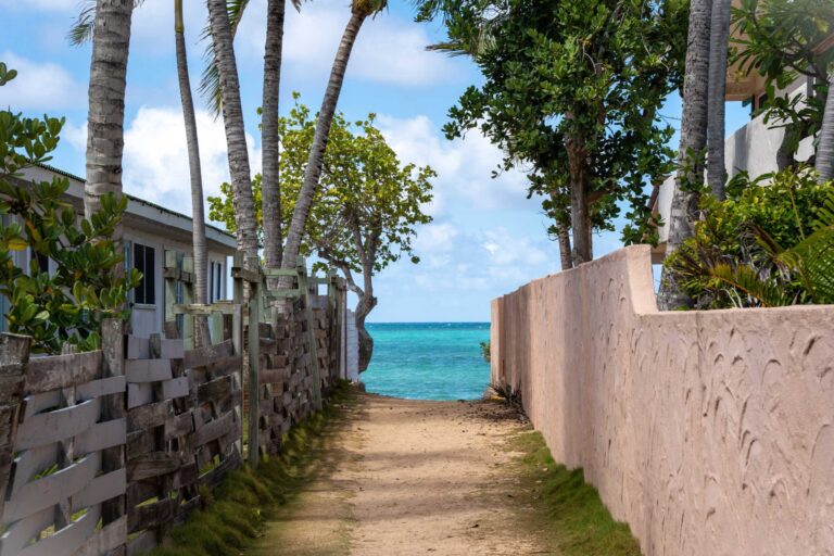
Lanikai Beach is about half a mile of public sand in Kailua, reached only by paths between houses. It is not a park: there is no public lot, restroom, shower or lifeguard tower, and the City is trying to keep cars off the one road in. Here are the paths, the parking rules, the sand, the water, sunrise and the Mokulua Islands rules.
Some links on this page are affiliate links. If you book or buy through them, we may earn a commission at no extra cost to you.
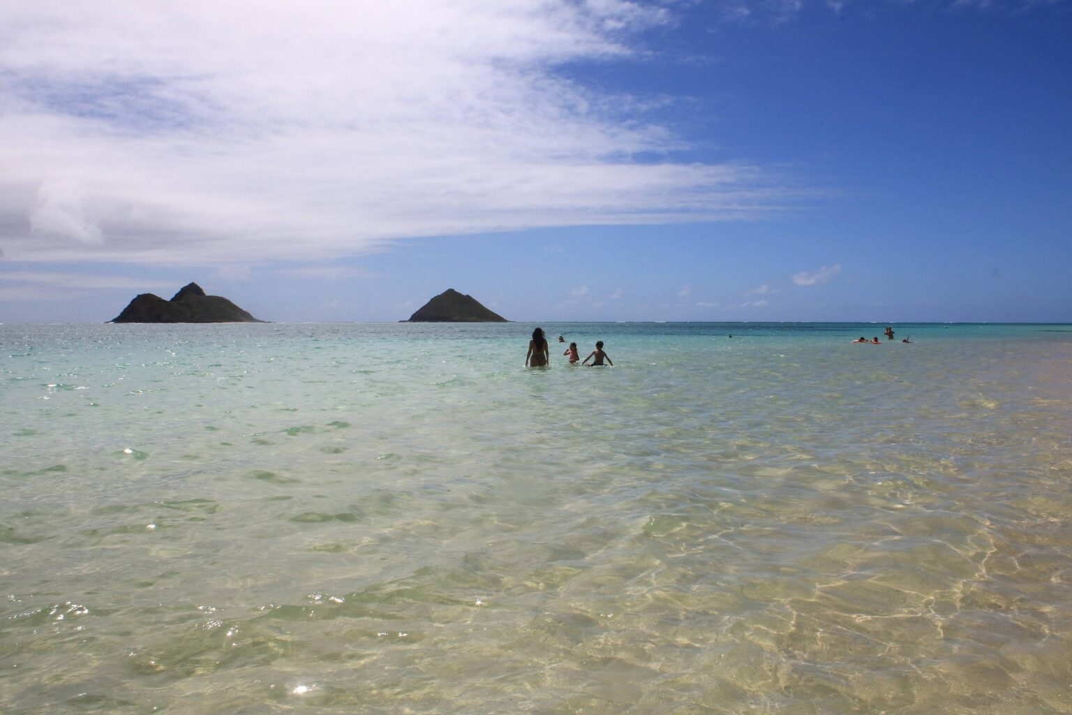
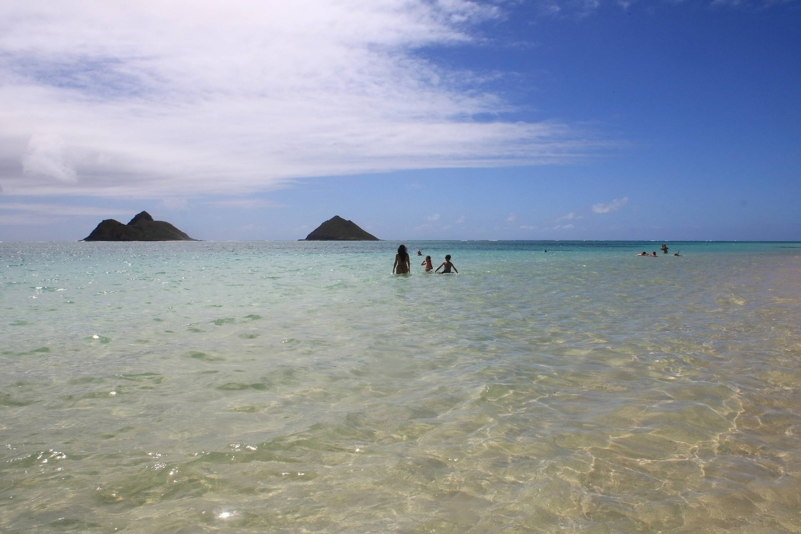
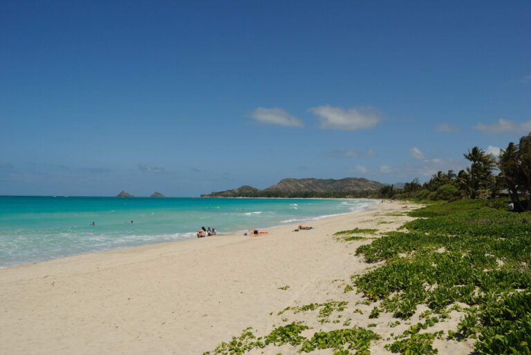
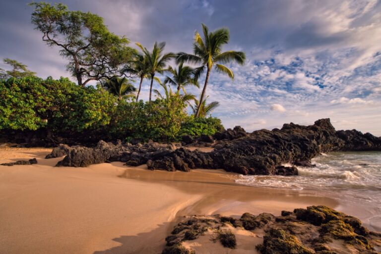
Lanikai Beach, June 2024. The Mokulua Islands sit on the horizon. Photo: claralieu, CC BY 2.0, via Wikimedia Commons.
Quick Answer
Lanikai Beach is public, but it has no public lot, restrooms, showers or lifeguards. Reach the sand by a path between houses on Mokulua Drive. Do not park on the shoulders: the City bans parking on Mokulua and Aʻalapapa drives from 10 a.m. to 3 p.m. on three-day holiday weekends. Park at Kailua Beach Park (about half a mile from the nearest path), ride TheBus 671 or get dropped off. Land on the Mokulua Islands only below the high-water mark, in daylight.
- Hours
- No posted hours: a public beach, not a City park
- Lifeguards
- None. Nearest: Towers 8 and 8B at Kailua Beach Park, 8 a.m. to 6:30 p.m.
- Parking
- No public lot; shoulder parking barred. Nearest City lots: Kailua Beach Park
- Restrooms
- None; nearest at Kailua Beach Park
- Length
- About half a mile of sand
- Bus
- TheBus 671, Kailua Town to the Lanikai loop
Facts from the City’s Lanikai transportation plan, Ocean Safety, DLNR and the University of Hawaii, checked Oct 14, 2026.
The Public Beach Paths Off Mokulua Drive
Lanikai Beach is public, but you reach it through paths between private homes. The City says its public and private shoreline access points lack restrooms, parking and shelter (DTS plan, June 2025). The sand seaward of the shoreline is State land.
Lanikai is a one-way loop. Aʻalapapa Drive is one leg; Mokulua Drive returns along the shore, and every path the State mapped is on it. No City or State page we found publishes one numbered list, and the sources differ:
| Source | What it counts |
|---|---|
| State survey, 2008 | Four paths on Mokulua Drive, labeled A to D; three have City locator numbers (94B, 94A, 93A). |
| Honolulu Advertiser, 2008 | Counted “a dozen beach accesses”; three had the City’s new signs. |
| DLNR permit list, 2025 | Five stretches, Lanikai Beach 1 to 5. Permit zones, not paths. |
| City plan, June 2026 | Five loading zones between Kaʻelepulu and Kuaʻilima drives. |
The City’s 2008 emergency signs carry a locator number you can read to a 911 dispatcher. From the Kailua Beach Park boat ramp lot it is about 0.5 mile to the nearest mapped path and 1.3 miles to the farthest, by our calculation on OpenStreetMap data.
The Narrowing Beach and the Seawalls
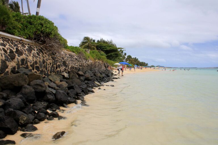
The sandy part is a narrow half mile of a 1.2-mile shoreline, and most of the rest has lost its beach. University of Hawaii researchers measured 4,000 feet of beach lost along this shoreline between 1911 and 2015: the north end between 1975 and 1982, the south end between 1988 and 2005. Seawalls now fix the shoreline there, and waves break against them (UH SOEST). The central half mile was gaining sand in places, but the study warns the loss at south Lanikai “continues to expand to the north threatening the remainder of Lanikai Beach.” ProPublica and the Star-Advertiser reported in 2020 that the county had approved 10 more seawalls here since 2000 (ProPublica). The newest measurement we found is from 2015, so expect less dry sand than older photos show.
Lifeguards, Water and Wind
There is no tower at Lanikai. Ocean Safety staffs Towers 8 and 8B at Kailua Beach Park and Tower 8C at Kalama Beach Park from 8 a.m. to 6:30 p.m., with mobile responders on 911 calls in those hours (Ocean Safety).
A fringing reef and the Mokulua Islands shelter the beach from the full force of ocean waves, but the coast takes trade-wind waves all year and north swell in winter (UH SOEST). Trade winds blow about 90 percent of the time in summer, 70 in fall and 50 in winter (NWS Honolulu). Man-o-war are most common in strong onshore winds, and a swimmer in a rip current should swim parallel to shore (beach signs). For a daily check, see Is it safe to swim on Oahu today.
Check the state water quality map after heavy rain. It posted bacteria notices for the Lanikai shoreline on October 23 and December 17, 2025, an advisory from December 19 to 23, and a brown water advisory for Kailua Bay on October 1, 2026.
Sunrise at Lanikai
Lanikai faces the Mokulua Islands, a view the City’s plan counts among the most photographed on social media. By our calculation from NOAA’s solar equations, sunrise is about 5:50 a.m. at the June solstice, 6:34 a.m. on October 31 and 7:04 a.m. at the December solstice (Hawaii Standard Time). From the two northern mapped paths the islands bear about 96 to 99 degrees, just south of due east. The sun rises at about 105 degrees on October 31, just right of the islands, and at about 115 degrees in December, well right. In June it rises at about 64 degrees, far left. These are straight-line figures, and clouds decide the rest.
Kailua Beach Park lots reopen at 5 a.m. (City closure hours; the park is closed midnight to 4 a.m.), so you can park legally before sunrise. Our Oahu sunrise guide covers other spots.
The Mokulua Islands: Landing Rules
The islands lie about 0.9 to 1.2 miles off the paths, by our calculation. Both are state seabird sanctuaries, restricted by DLNR (DLNR): access below the high-water mark only, closed sunset to sunrise, and no fires, dogs, camping, tents, tarps or structures. Under the sanctuary rules (Chapter 13-126) a paddler may beach a boat below the high-water mark without a landing permit. A business needs a written permit, possible on Mokulua Nui only, and a rented kayak must carry its shop’s sanctuary sticker.
Closures happen. After a monk seal pup was born on Mokulua Nui in June 2024, DLNR suspended commercial landings (DLNR), and the shoreline stayed closed from July 13 to October 7 (DLNR). In 2015 Ocean Safety said dozens of people had jumped or fallen from the islands’ cliffs that year (DLNR). Check the islets page before you paddle out. Launching and City rules are in our Kailua Beach Park guide.
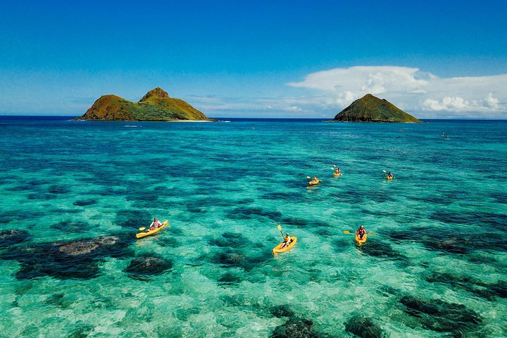
Kayak to the Mokulua Islands, Queen’s Bath and Snorkel
★★★★★ 5 · 426 reviews · From $234
Check AvailabilityWe may earn a commission if you book through this link, at no extra cost to you.
Restrooms, Showers and Where to Find Them
Lanikai has none (DTS plan). The nearest are at Kailua Beach Park: a comfort station with restrooms and outdoor showers beside the boat ramp lot (City study, 2022), closed with the lots from 10 p.m. to 5 a.m. Use them first, and bring water.
Getting There and the Parking Reality
Driving: about 16 miles and 35 minutes from central Waikīkī to the Kailua Beach Park boat ramp lot without traffic, by our calculation. The route runs over the Pali Highway, where the Nuʻuanu Pali Lookout sits, and the coast road from Waimānalo is in our East Side Oahu drive. Lanikai has one road in, Lihiwai Road to Kawailoa Road to Alāla Road to Mokulua Drive, and no other public exit (DTS plan).
Parking: there is no public lot. Aʻalapapa and Mokulua drives have no on-street parking, and the shoulders are legally unimproved sidewalks where parking is barred. Police told DTS they struggle to ticket and tow on the shoulders without signs, and can where signs or barricades are posted. On peak days more than 171 cars park illegally (DTS plan), and the neighborhood board chair said in 2025 that as many as 300 are jammed in (Civil Beat).
Bans: on three-day holiday weekends DTS bans parking on Mokulua and Aʻalapapa drives, their shoulders and the cross streets from 10 a.m. to 3 p.m.; the latest notice we found covered January 1 to 4, 2026 (DTS). Permanent “No Parking Any Time” signs on Mokulua Drive come first in the City’s plan, with $500,000 budgeted for 2026-27 and no construction schedule (Mayor’s office, June 2026).
Options: park at Kailua Beach Park (leave the trailer spaces to boaters) and walk 0.5 to 1.3 miles; DTS has asked visitors to consider other beaches or TheBus 671 (DTS). On Saturdays the schedule shows 18 trips toward Lanikai about every 40 minutes, the first at the Kailua Beach Park stop around 6:50 a.m. and the last Kailua-bound one passing it around 7:05 p.m. (TheBus data); see our getting around Oahu guide. Or get dropped off: Phase 1 of the plan puts five loading zones across the paths.
The Lanikai Pillbox hike starts on Kaʻelepulu Drive, with no parking or restrooms, says the City, and Nā Ala Hele says not to drive or park beyond that street (trail record).
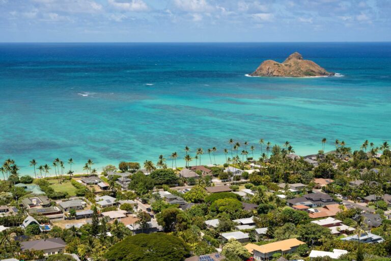
Lanikai Beach vs Kailua Beach Park
The two beaches share a road and are often mistaken for one stretch of sand. They have different rules.
| Detail | Lanikai Beach | Kailua Beach Park |
|---|---|---|
| Lifeguards | None | Towers 8 and 8B, 8 a.m. to 6:30 p.m. |
| Parking | No public lot | City lots; about 68 spaces at the boat ramp lot (2022) |
| Restrooms, showers | None | Comfort station and outdoor showers |
| Commercial activity | State permit needed on the sand | Restricted by the City |
| Best for | The Mokulua view and sunrise, on foot or by bus | A full day with facilities and the kayak launch |
If neither suits your day, Kualoa Regional Park and Kahana Bay Beach Park are further up the Windward coast. See things to do on Oahu for the rest of the island and our snorkeling guide for snorkeling.

Popoiʻa Island Hopper Guided Kayak Tour and Snorkeling
★★★★★ 5 · 500 reviews · From $170
Check AvailabilityWe may earn a commission if you book through this link, at no extra cost to you.
Rules, Commercial Activity and Neighborhood Etiquette
Commercial activity: State law requires a permit for commercial activity on State beaches, meaning use of State land for which compensation is received for goods or services rendered to participants. DLNR’s examples are a beach wedding, a christening and a memorial service (Wiki Permits). Permits last up to two hours and cost $0.10 a square foot, with a $20 minimum (DLNR FAQ, 2016); see our beach wedding permit guide. Tour operators also need the Mokulua permits above.
Etiquette: among the 188 people who commented on the City’s draft plan, 90 percent lived in Lanikai, and “over tourism” and disrespect for the environment were regularly cited (DTS plan). The Lanikai Association’s former longtime president told Civil Beat in 2025, “We don’t want your cars” (Civil Beat). Stay on the marked path, never block a driveway or sidewalk, and arrive without a car if you can.
Lanikai Beach: Questions
Is Lanikai Beach public?
Yes. The sand is State shoreline, reached by public paths between the houses on Mokulua Drive. There is no park, so no public lot, restroom, shower or lifeguard.
Is there parking at Lanikai Beach?
No public lot. Shoulder parking is barred, and the City bans parking on Mokulua and Aʻalapapa drives from 10 a.m. to 3 p.m. on three-day holiday weekends. The nearest City lots are at Kailua Beach Park.
How many public beach access paths does Lanikai have?
No official list exists. The State’s 2008 survey mapped four on Mokulua Drive, and a 2008 news story counted a dozen.
Are there lifeguards at Lanikai Beach?
No. Ocean Safety staffs Towers 8 and 8B at Kailua Beach Park and 8C at Kalama Beach Park, 8 a.m. to 6:30 p.m.
What time is sunrise at Lanikai Beach?
About 5:50 a.m. in June, 6:34 a.m. on October 31 and 7:04 a.m. in December, by our calculation.
Can I land on the Mokulua Islands?
Only below the high-water mark and in daylight, with no dogs, fires or camping. Check DLNR’s islets page for closures first.
Sources, checked Oct 14, 2026
- Lanikai Transportation Management Plan (City DTS, June 2025)
- Parking regulations update (Mayor’s office, June 15, 2026)
- Lanikai holiday parking restrictions (City DTS, Dec 24, 2025)
- Additional Lanikai parking restrictions (City DTS, Jan 25, 2025)
- Shoreline Public Access layer (State Office of Planning and Sustainable Development)
- Wiki Permit beach locations (State DLNR, May 9, 2025)
- Wiki Permits: commercial activity (State DLNR)
- Wiki Permits FAQ (State DLNR, 2016)
- Lanikai area description, shoreline change 1911 to 2015 (UH SOEST)
- Officials let Hawaii’s waterfront homeowners damage public beaches (ProPublica, Dec 31, 2020)
- Parking will be banned in Lanikai loop (Civil Beat, Jul 11, 2025)
- Beach emergency location signs (Honolulu Advertiser, Jan 17, 2008)
- Lifeguard tower locations (Honolulu Ocean Safety)
- Understanding beach signs (Honolulu Ocean Safety)
- Park closure hours (City DPR)
- Kailua Beach Park Boat Ramp Feasibility Study (City DDC, May 2024)
- Oahu offshore islet sanctuaries (State DLNR)
- Wildlife sanctuary rules, Chapter 13-126 (State DLNR)
- Monk seal born on Mokulua Nui (DLNR, Jun 24, 2024)
- Mokulua Nui shoreline closure ends (DLNR, Oct 2, 2024)
- Offshore islets: no booze, no dogs, no fires (DLNR, May 22, 2015)
- Water quality advisories (Hawaii Department of Health)
- Weather FAQ, trade winds (National Weather Service Honolulu)
- TheBus GTFS schedule data (feed from Aug 9, 2026)
- Kaiwa Ridge (Lanikai Pill Box) trail record (State Nā Ala Hele)
Researched from the sources above, checked Oct 14, 2026. We never claim a visit we did not make; first-hand notes are marked as Stew’s. How we research and review.
Leave a Reply